

Find wildflowers, vibrant red sunsets, and peaks that take your breath away on this 18km hike through Victoria’s Alpine National Park. We acknowledge that this adventure is located on the traditional Country of the Gunaikurnai and Taungurung people...

Find wildflowers, vibrant red sunsets, and peaks that take your breath away on this 18km hike through Victoria’s Alpine National Park.
We acknowledge that this adventure is located on the traditional Country of the Gunaikurnai and Taungurung people who have occupied and cared for the lands, waters, and their inhabitants for thousands of years. We pay our respects to them as the Traditional Custodians and recognise that sovereignty was never ceded.
Quick Overview
The Grade 4 Hotham Huts Walk circuit connects multiple summer walking trails in the Victorian High Country, including the Australian Alps Walking Track, the Cobungra Ditch Walking Track, and the Davenport Access Track. Each section has a slightly different feel, lending variety to the trail that passes by multiple huts.
The walk can be treated either as an 18km circuit hike, incorporating a 3km stretch of road through Hotham Village, or as a slightly shorter 15km one-way end-to-end trip from car park to car park.
Wildflower season is the vibe
Mt Hotham Huts Walk Facts
Distance: 18km circuit (including detours to Silver Brumby Hut and Derrick Hut)
Duration: 7 to 8 hours (hiking time)
Elevation gain: 966m
Nearest Town: Mt Hotham Village
About Mt Hotham Huts Walk
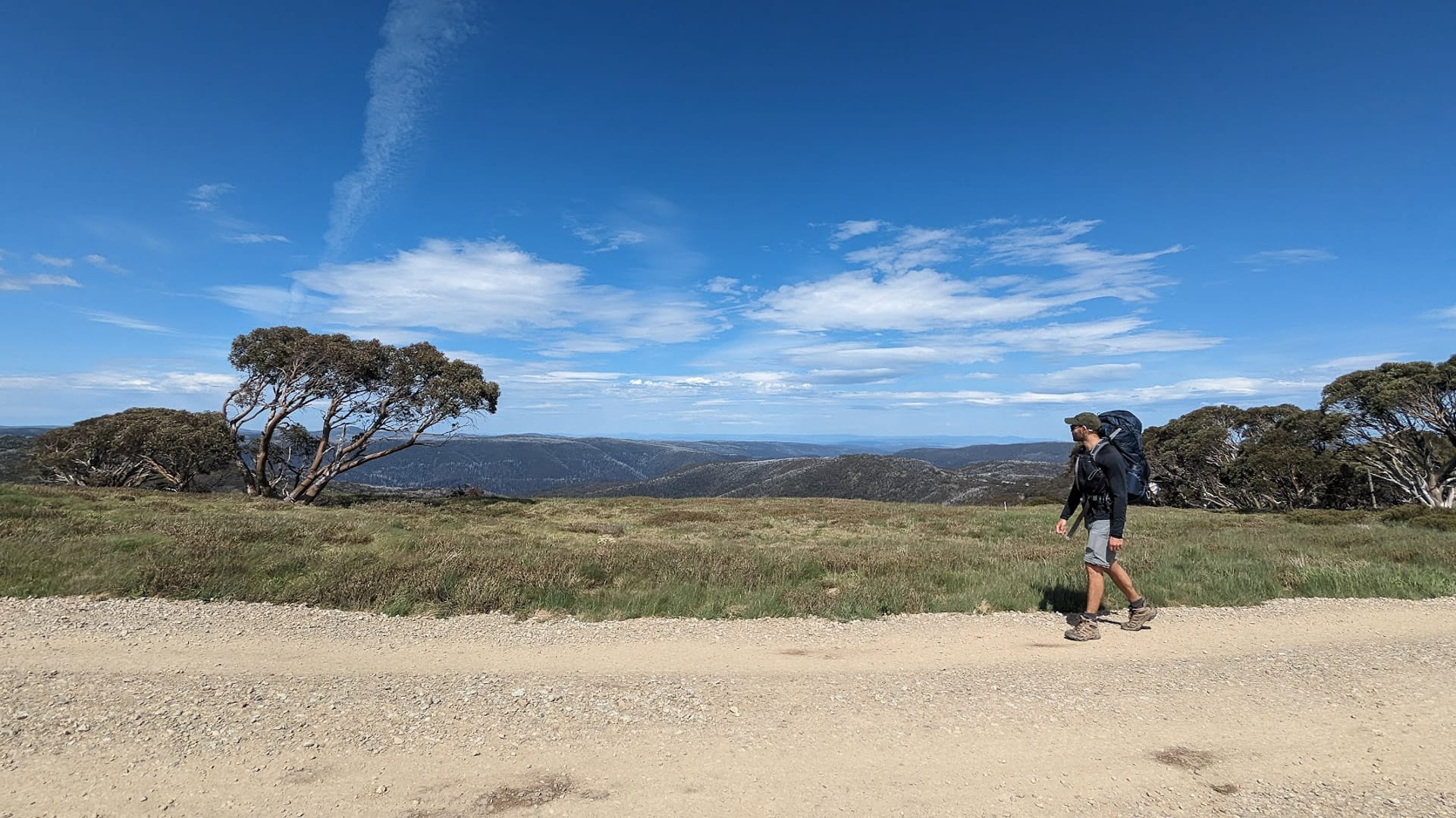
The Hotham Huts Walk in Victoria has everything a hiker could want in a summer walking trail. Elevation to keep you cool, views for miles, weather that keeps you on your toes, brightly coloured wildflowers that change every month… It has so much variety that you could visit the trail five times and always have a unique experience.
It’s most commonly walked in a clockwise direction as this means that you go down – rather than up – the 1.4km of very steep, very constant incline at Golden Point Spur. It doesn’t mean you can’t go the other way, but most people head in the path of least resistance.
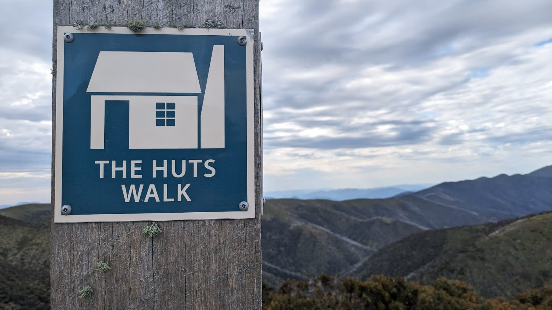
You’ll follow these cute signs all day
One-way: 15km
Start at Loch Car Park and finish where the Davenport Access Track meets the B500, (or vice versa).
Circuit: 18km
Park your car at the Davenport car park or outside the General Store (check with the staff first). Either walk along the B500 (quite boring) or take our scenic route and head up the Mt Higginbotham Track, which runs parallel to the B500, for gorgeous views over the opposite side of Hotham Village to the Huts Walk.
Follow this path up and over the mountain for about 30 minutes to reach the Hotham Village Tourist Information Centre located in Corral Car Park.
After passing this, head up the Mt Hotham Summit Walk past Baldy Mine and make a right. Follow the signs for the Australian Alps Walking Track and you’ll end up in Loch Car Park at the Huts Walk trailhead.
Day Hike Or Overnight?
With an average duration of seven hours, the Huts walk is mostly done as a day hike, but we chose to take our time and did it overnight, camping at Derrick Hut.
Read more: Remember to Leave No Trace
Mt Hotham Huts Walk History
People have been visiting Victoria’s Alpine National Park for thousands of years. Originally frequented by the Traditional Owners, the Gunaikurnai and Taungurung people, the land was eventually explored by Europeans in the mid-1830s.
Gold was discovered in the Hotham region in the 1850s and people began to visit the area for winter skiing in the 1880s and 90s. In the 1920s, the Hotham Heights Chalet was built, which was the beginning of establishing the area as a skiing destination.
Purple flowers on the Machinery Spur Track
Nowadays the Mt Hotham Alpine Resort and surrounding Alpine National Park are used throughout the entire year. When the ski runs aren’t active, the hiking trails are. The Huts Walk spans multiple summer walking trails in the Victorian High Country, including the Australian Alps Walking Track, the Cobungra Ditch Walking Track, and the Davenport Access Track.
While you can technically visit four huts on the Huts Walk (the Joyce Brockhoff Hut is a bonus!), it was constructed to connect three historically significant huts. These include Derrick Hut (built in 1967 in memory of deceased alpine skier Charles Derrick), Spargo’s Hut (built for gold mining in 1927-8), and the Silver Brumby Hut (built in 2006 as a replica of the 1992 original that was constructed for the Silver Brumby movie).
Silver Brumby Hut doing its best to win the most aesthetic hut sweepstakes
How To Get to Mt Hotham Huts Walk
From Melbourne CBD (via Gippsland) – 5 hours and 40 minutes
Jump on the M1/Monash Freeway and head towards Gippsland. At Bairnsdale, the A1 becomes the B500/Great Alpine Road. Continue following it towards Bruthen where it branches off to the left towards Mt Hotham. After 459km, you’ll arrive in Mt Hotham Village.
If you want to break up the drive, consider stopping in Sale for lunch. The Port of Sale is a great precinct with restaurants, a library, a skate park, free Wifi, and plenty of parking.
Top Tip: Don’t forget to stop off at the Kosciuszko Lookout a few kilometres below the Hotham Alpine Resort for a view of the tallest mountain in Australia.
Read more: Hiking the 10 Highest Peaks in Australia
From Melbourne CBD (via Bright) – 4 hours and 30 minutes
Take the M2/Citylink and head north along the M31/Hume Freeway towards Benalla. Follow signs towards Bright and Harrietville. After approximately 376km you’ll arrive in Mt Hotham Village.
A good place to stop for a bite to eat on the way is Main Street Café Benalla. Stretch the legs in the Benalla Botanical Gardens and continue your drive thoroughly refreshed.
Getting to the start of the walk from Mount Hotham village
The Hotham Huts Walk starts at the Loch Car Park and ends at the Davenport Access Track, opposite the Tanderra Ski Lodge on the Great Alpine Road. Parking is readily available at both ends.
I recommend parking in the large Corral Car Park or opposite the police station near The General. This means you’ll be right next to the general store, pub, and toilets at either end of the walk for ultimate convenience.
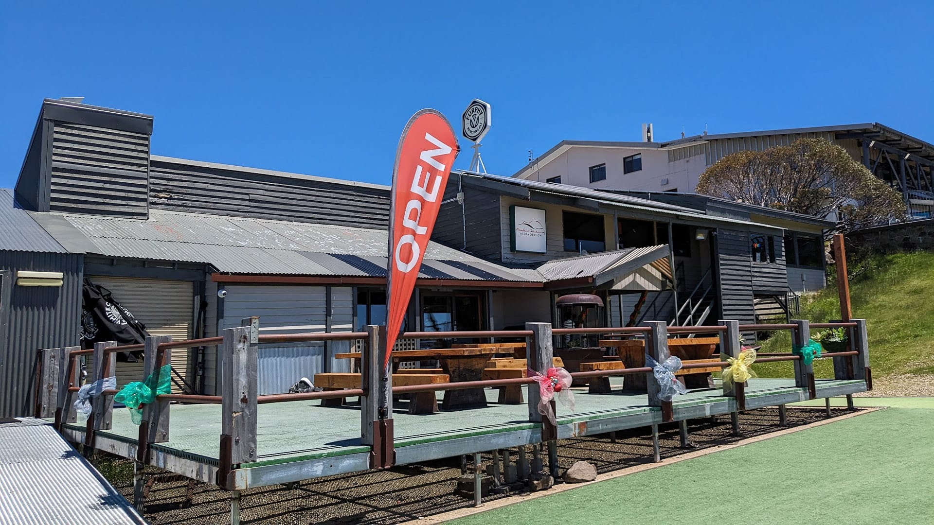
The General Hotel
Where to Stay At Mt Hotham
Mt Hotham Village
If you’re keen to tackle the Hotham Huts Walk in one day, you’ll want a comfy place to rest your head (legs, back, feet…) afterward. There are plenty of accommodation providers in Hotham Village and they’re perfectly located so that your weary body doesn’t have to travel any further than necessary after eight hours on the trail.
Asgaard Alpine Club Lodge
The Asgaard Alpine Club Lodge offers budget-friendly accommodation less than 200m from The General Store. At only $60 per head, per night, it’s a colossal bargain.
I always thought accommodation in the Alpine National Park would be prohibitively expensive, but I couldn’t have been more wrong. I can’t be the only one just finding out about this, right?
Since making this discovery I’ve been hurriedly planning weekend trips and figuring out what other day walks I can do in a weekend trip. Want to do the same? Check out the Hotham Trails Map and the full list of summer accommodation options at Mt Hotham.
Eco-Glamping Alpine Nature Experience
Next time I head to Mt Hotham, you’ll probably find me snuggled up in a tent hanging suspended between two trees. Yep, tent camping above the ground. I initially considered the Eco-Glamping Alpine Nature Experience for the pure novelty of it, but a cooked breakfast, comfy mattress, and promised stellar views are all pretty convincing.
At $189 for an overnight hover at Hotham, it sounds like a great way to treat yourself while still being connected to nature.
Hotham Huts Walk
The most logical stopping point to pitch your tent on the Hotham Huts Walk is at Derrick Hut. It took us about three hours to get there from the Loch Car Park.
Turn the Hotham Huts Walk into an overnighter!
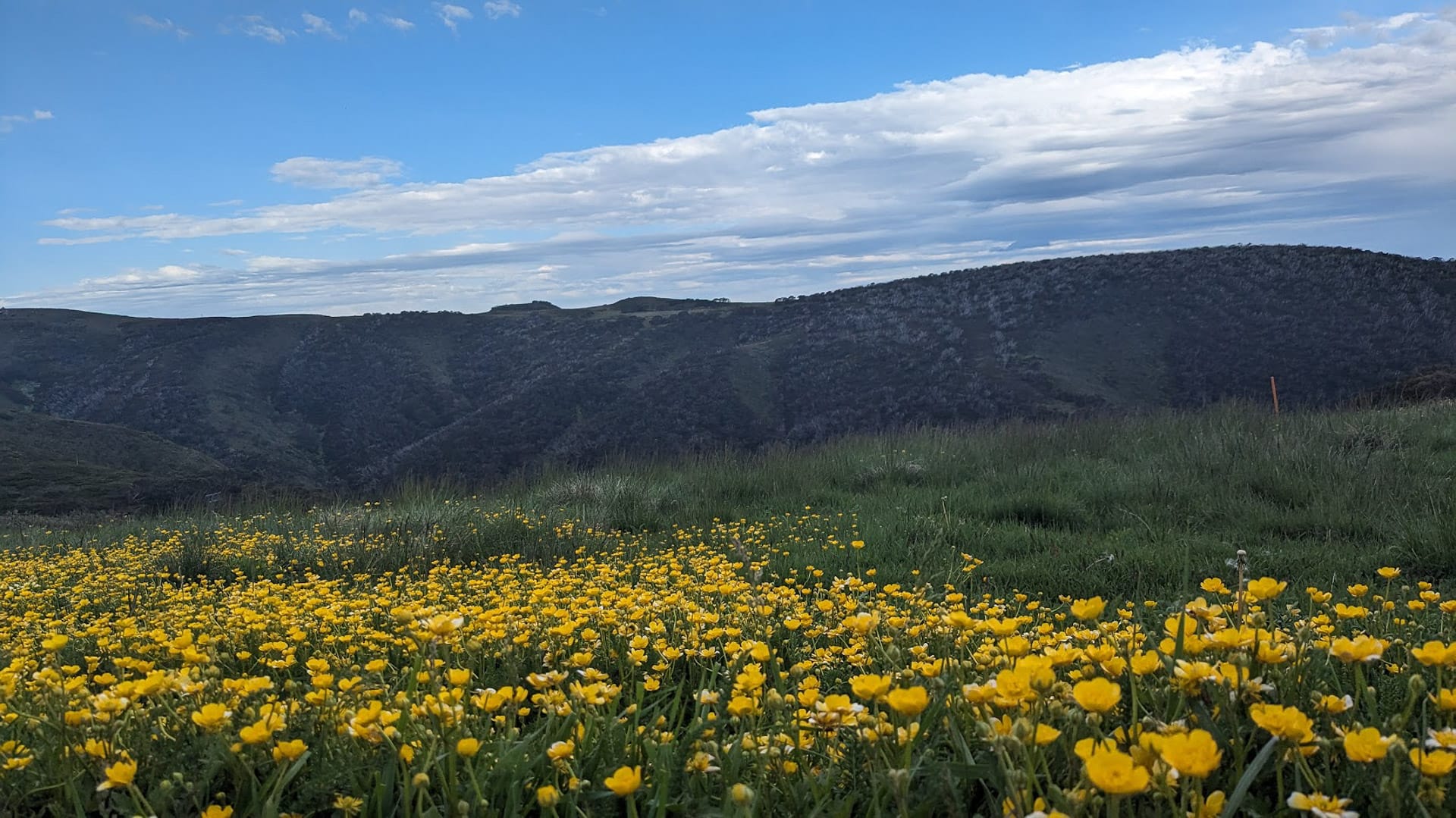
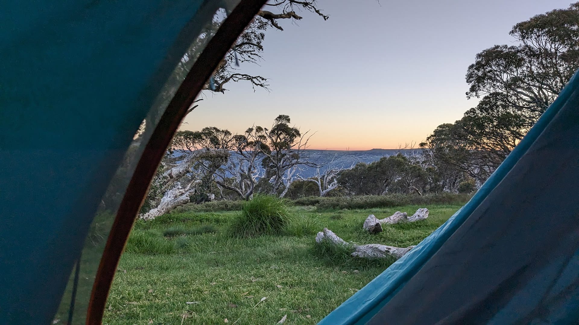
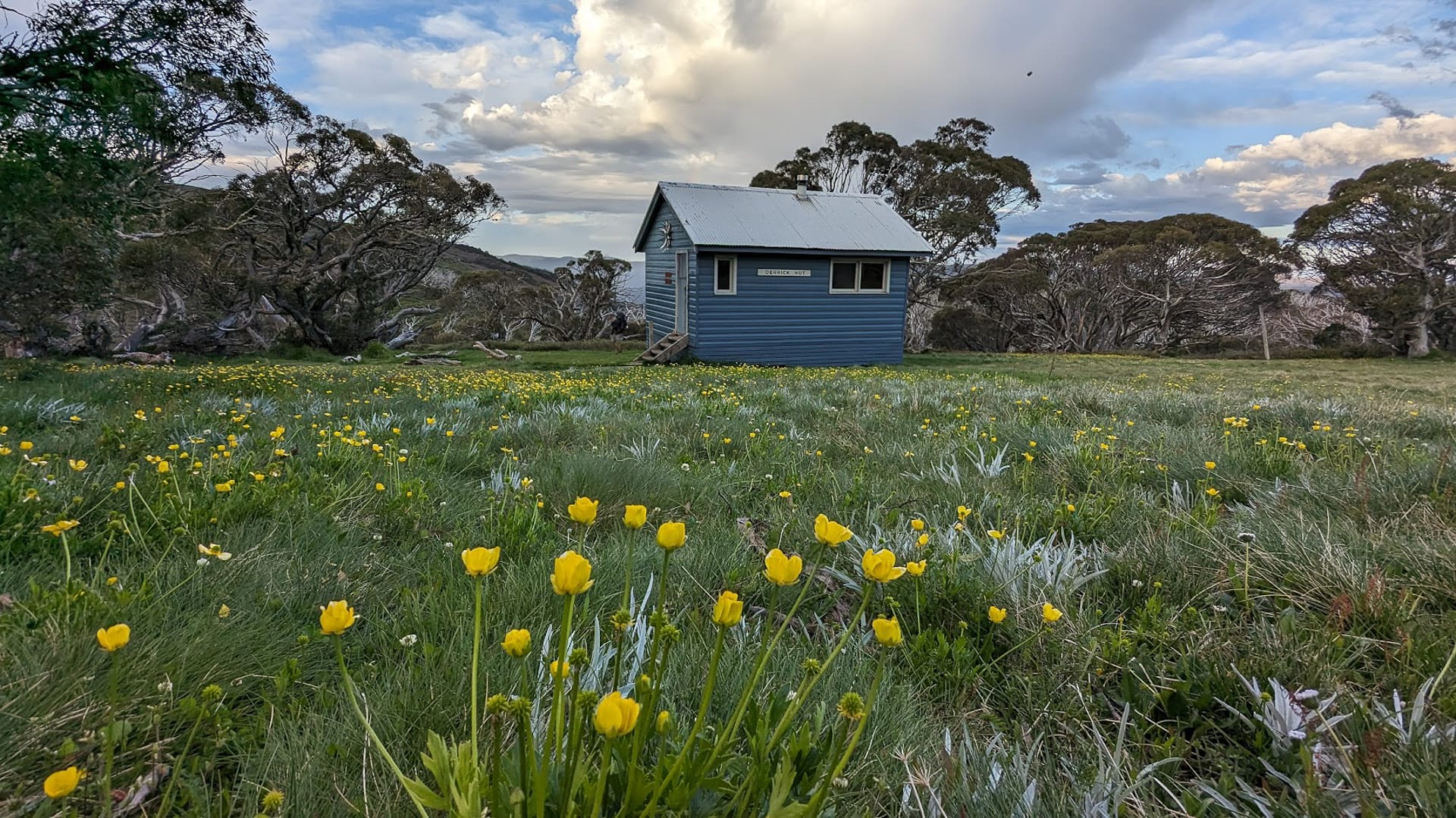
Derrick Hut is located in a gorgeous floral meadow, which in summer is peppered with yellow Victorian Buttercups. As it’s located on the side of a mountain there isn’t a perfect flat spot to be found for your tent so you will be sleeping on an angle. This is a small compromise to make for the panoramic views, pastel skies, and fiery sunrise you’ll enjoy if you choose to stay overnight.
If you want to walk a bit further before calling it a night you could even push on past Derrick Hut and stay by Dibbins Hut. It’s located on beautiful flats by the river and I’ve heard it’s bliss.
Note: You cannot sleep in the huts – they’re strictly for day use, or for emergency situations only.
Read more: Victorian High Country Huts Association
Skill Level
The Mt Hotham Huts Walk is a Grade 4 circuit, which means that bushwalking experience is recommended. While many sections of the trail double as vehicle access tracks, that doesn’t cancel out the extremely steep, rough, or vaguely signed areas.
If you are fit, have hiked previously, have appropriate safety gear, and are walking with a buddy for a day hike – you’ll love this.
Don’t attempt this one overnight unless you’ve got multiple overnight trips under your belt and a buddy tags along to keep you company. Water is extremely limited on the trail so depending on the weather, you may need to carry two days’ worth (not easy!)
No experience hiking but you’re fit and want to give it a go? You’re in luck! Mt Hotham Resort Management runs free guided day walks.
There are options for all skill levels!
Essential Gear for Hotham Huts Walk
Day Hike
First aid kit PLB Water (enough for your expected duration, and a contingency – just in case) Layers (the weather is as unpredictable as a cat chasing shadows) Snacks Sunscreen, hat, and sunglasses Head net (optional – if you find flies very annoying) Gaiters (for the snakey sections along Cobungra Ditch Walking Track)??Day Hike Gear List: Packing List for a Day Hike
Overnight Hike
Take everything in the above list, plus:
Tent Sleeping mat with a minimum R-value of two Sleeping bag rated to at least 2°C lower than the expected minimum temperature Head torch Water purification method (we took LifeStraw bottles) Cooking gear Meals Thermals and beanie (non-negotiable, yes, even in summer!)Check out our guide to packing for an overnight hike!
Tents are a must for overnight missions as you can’t sleep in the huts
What it’s Like to Hike Hotham Huts Walk
While the Hotham Huts Walk is most commonly enjoyed as a day hike, we decided to bed down overnight at Derrick’s Hut to enjoy as much time as possible on the trail.
We wanted to avoid walking along the Great Alpine Road to maximise our time looking at mountains. With the guidance of the team at the Mt Hotham Information Centre we figured out that we could walk along either Higgi Drive or the Mt Higginbotham Trail instead. This took about thirty minutes and was a great introduction to the Alpine Resort.
After a small section along the road, we deviated once more onto the Mt Hotham Summit Walk to eventually reach the Loch Car Park, where the Huts Walk begins.
The Mt Higginbotham Track is an alternative to walking along the road
Mt Loch Car Park to Mt Loch
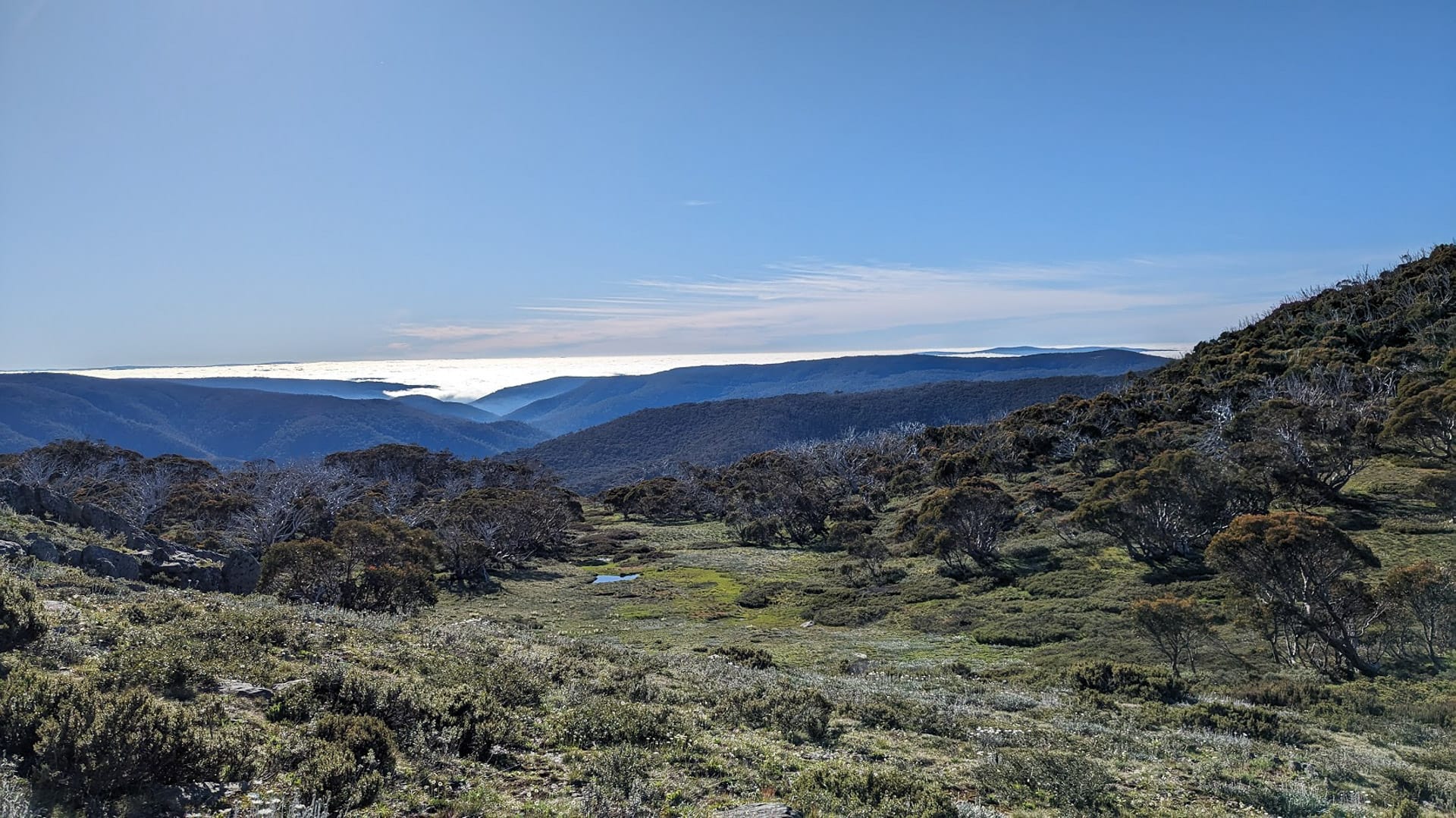
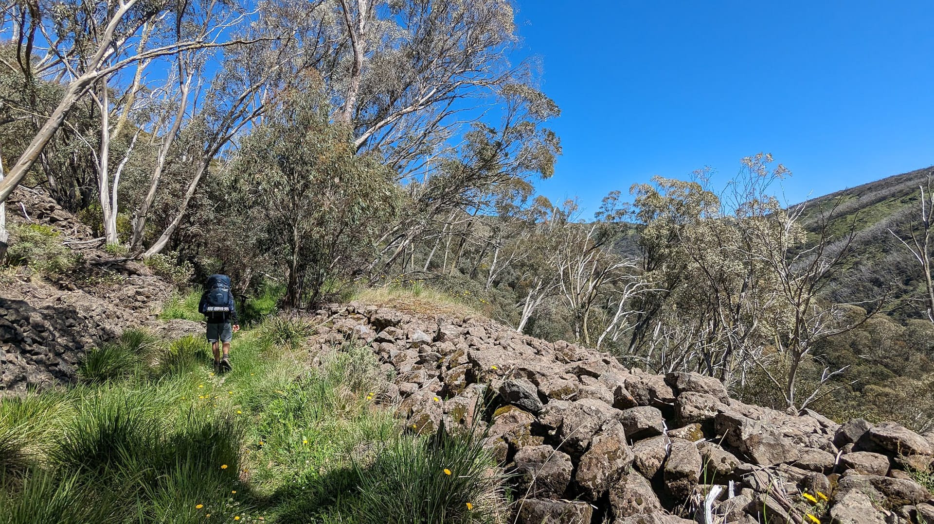
The trail starts along the Machinery Spur Track, a ridgeline with phenomenal views to both sides. While the sun was hidden behind an umbrella of clouds for most of the 2.9km to the Mt Loch turn-off, we were treated to multiple flashes of rainbows that disappeared as quickly as they came.
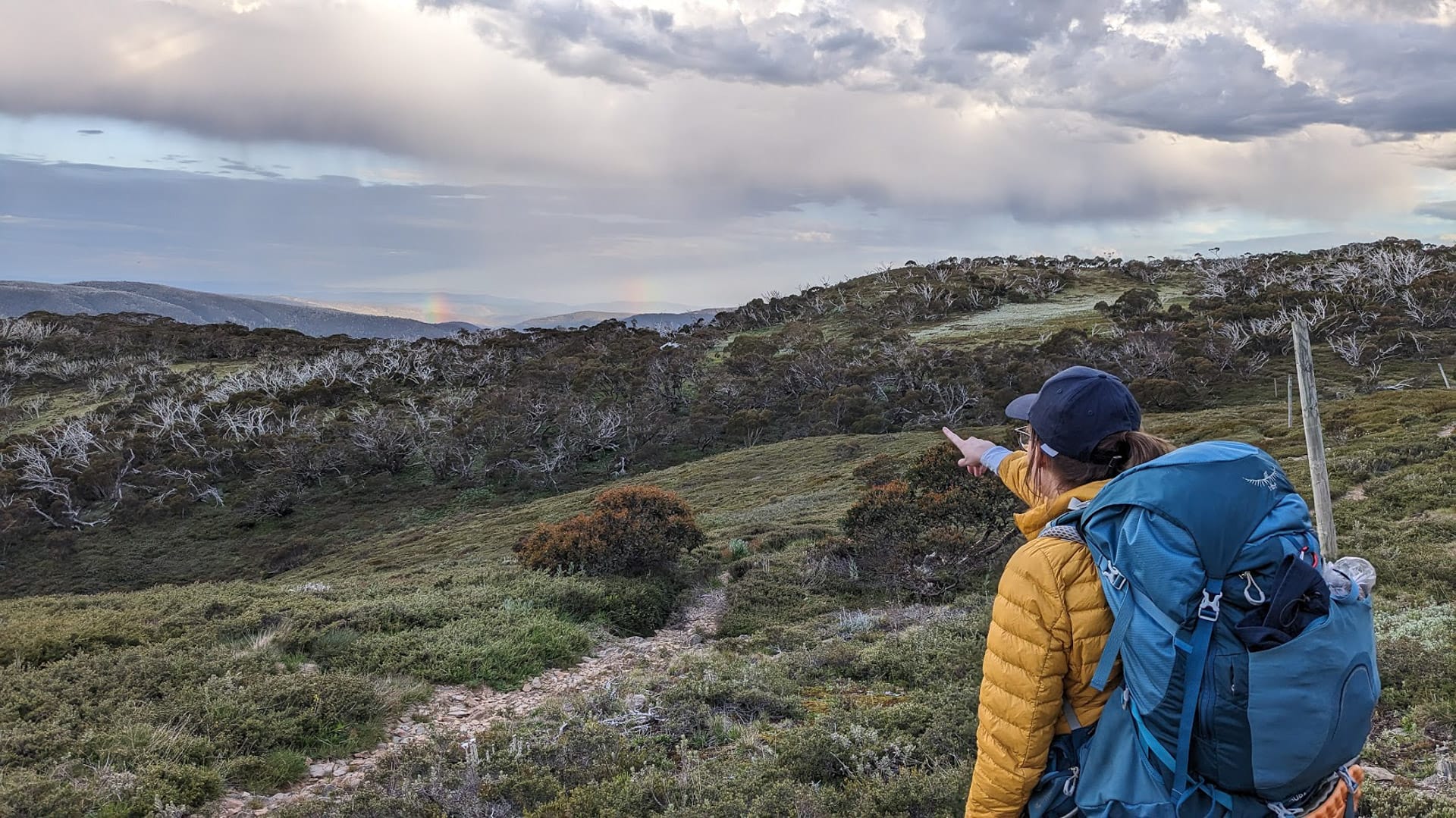
Cheeky rainbows are a bonus
This section is wide enough for cars (used by Hotham Management and authorised vehicles only) and was well-graded underfoot. This meant that unlike most of the hiking we do, which is technical and requires us to watch our feet almost constantly to avoid stacking it, we could walk confidently, letting our eyes wander around the vistas in every direction. It was really relaxing.
Ridgeline views on the Machinery Spur Track
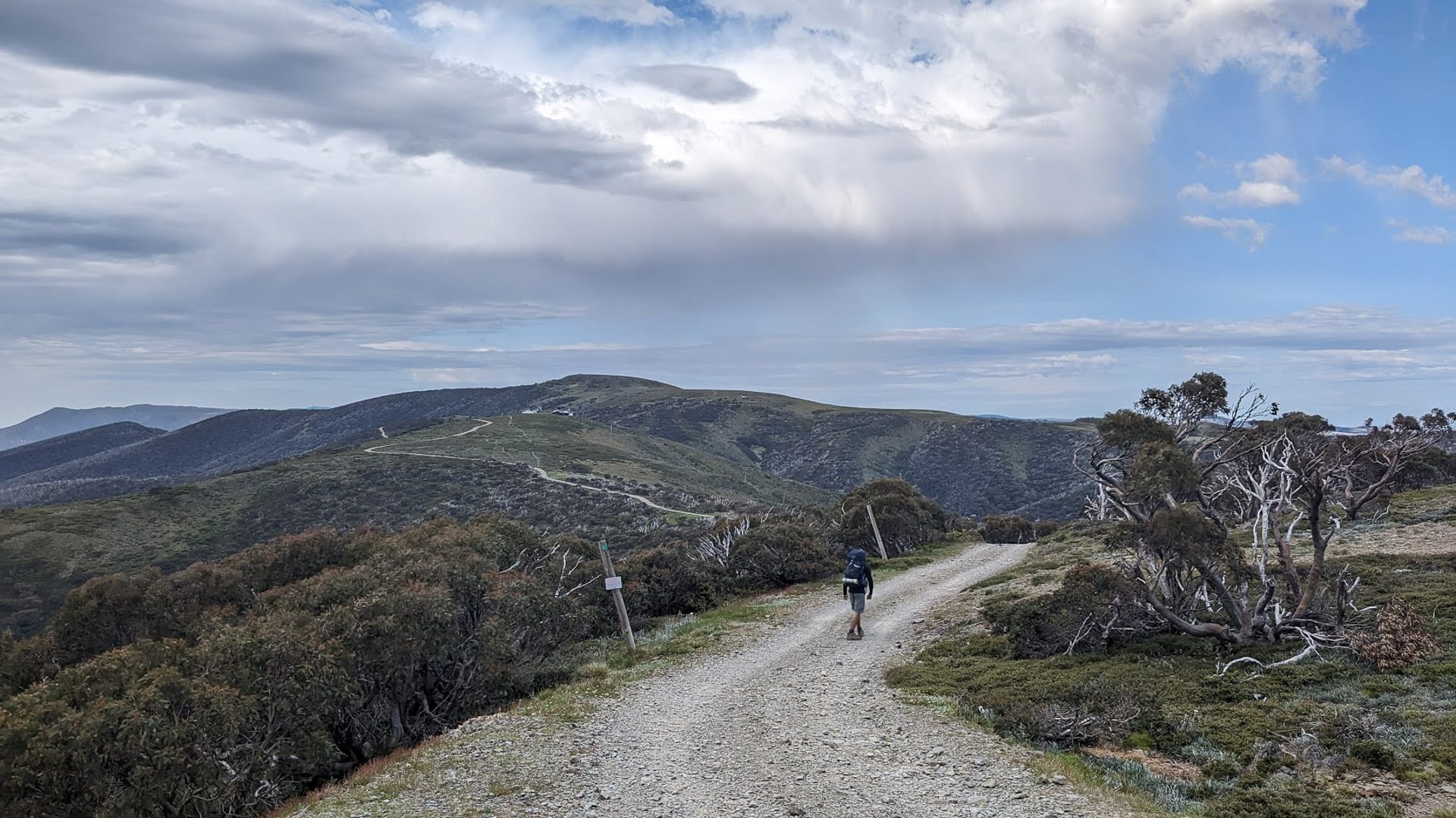
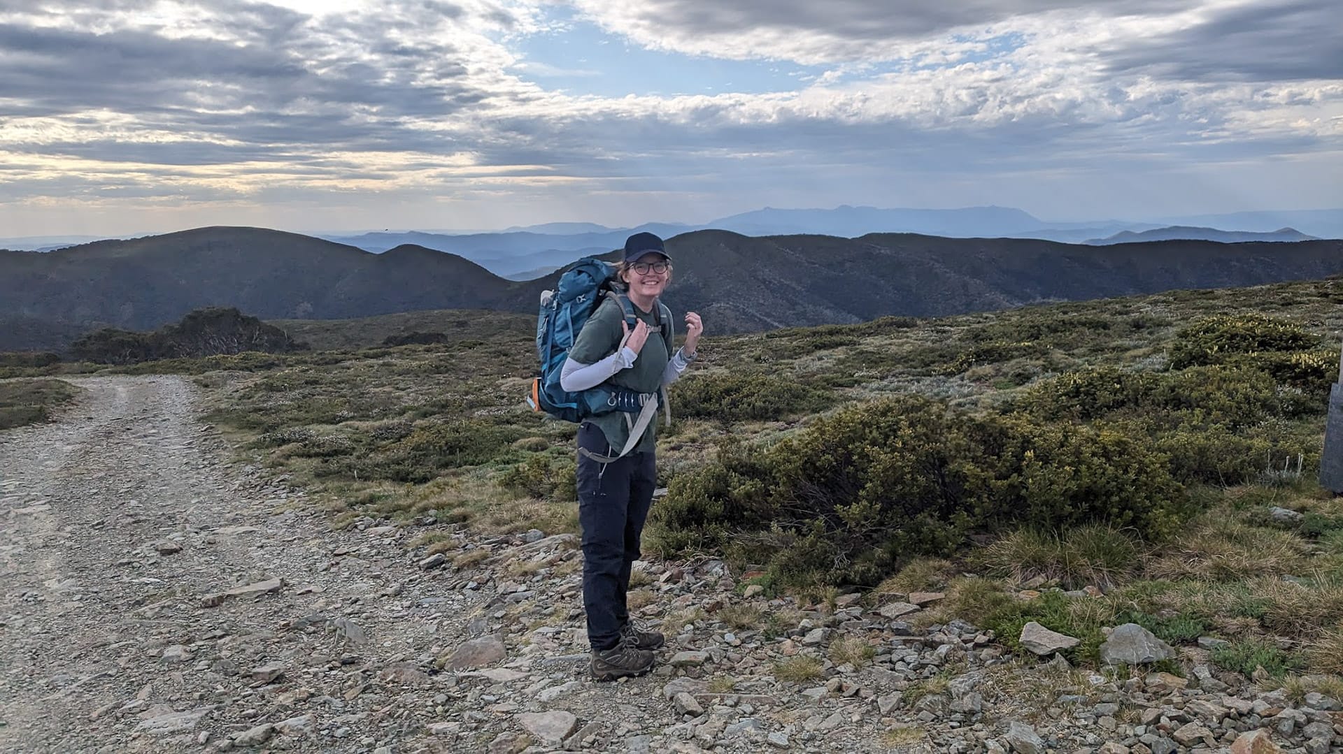
Slowly the trail began to inch upwards in incline and we followed the track laid out before us and guessed the big shape in the distance must be Mt Loch – correct! Reaching the trail marker, we shucked off our packs, both breathing a sigh of relief, as unburdened, we headed left for the lofty Mt Loch summit.
I normally expect a summit hike to be gruelling with plenty of steep inclines. This trail up Mt Loch couldn’t have been more opposite. Sure, it was a hill, but it was so gradual that we didn’t even break a sweat.
Ditch your pack for the climb up Mt Loch
The last 100m stepped it up a notch in terms of incline, but even arriving at the top, it was hard to understand how we were suddenly so high up. This moment standing beside the cairn was one that you’ll never forget. I simultaneously felt like I was on top of the world, and completely dwarfed by the scale of the mountains surrounding us, rolling away in static waves in every direction.
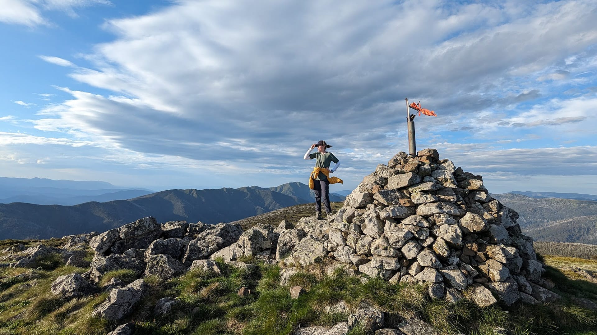
Some voodoo makes this summit feel much higher than the climb
It was magical.
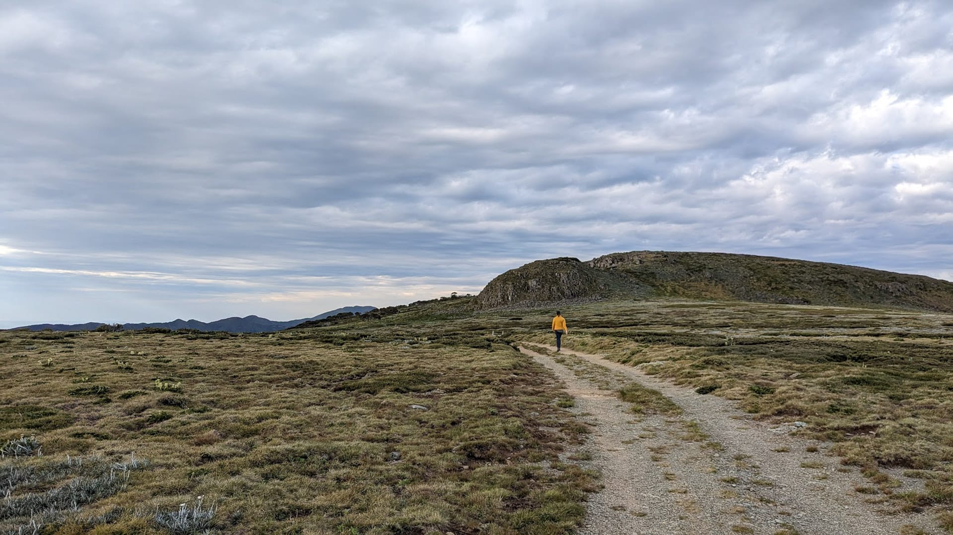
Sadly, the sun was edging ever closer to the horizon and it was time to get a wriggle on if we wanted to make it to Derrick Hut before sunset. We hastily picked our way back through the rocks, following the flowers to reach the main trail below the summit. In fifteen minutes we were shouldering our bags.
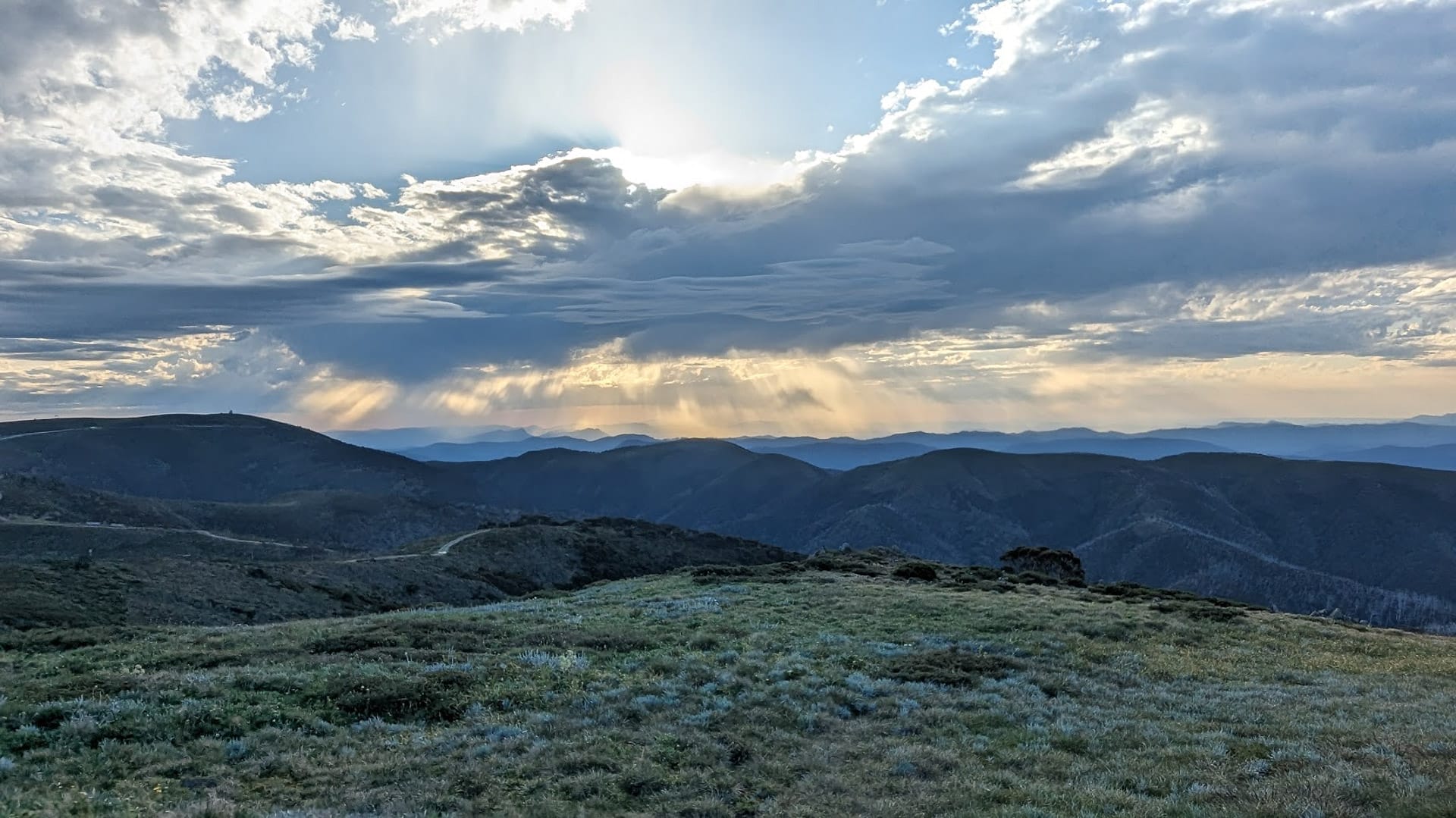
Clouds make for better sunsets
Mt Loch to Derrick Hut
There was only 1.4km between the trail marker at the turn-off to Mt Loch and our intended campsite at Derrick Hut. The trail in between was lit in a gorgeous glow from the rapidly setting sun and we were the only people in sight. We hadn’t seen anyone all day and it felt so extravagant to have the beautiful surroundings all to ourselves.
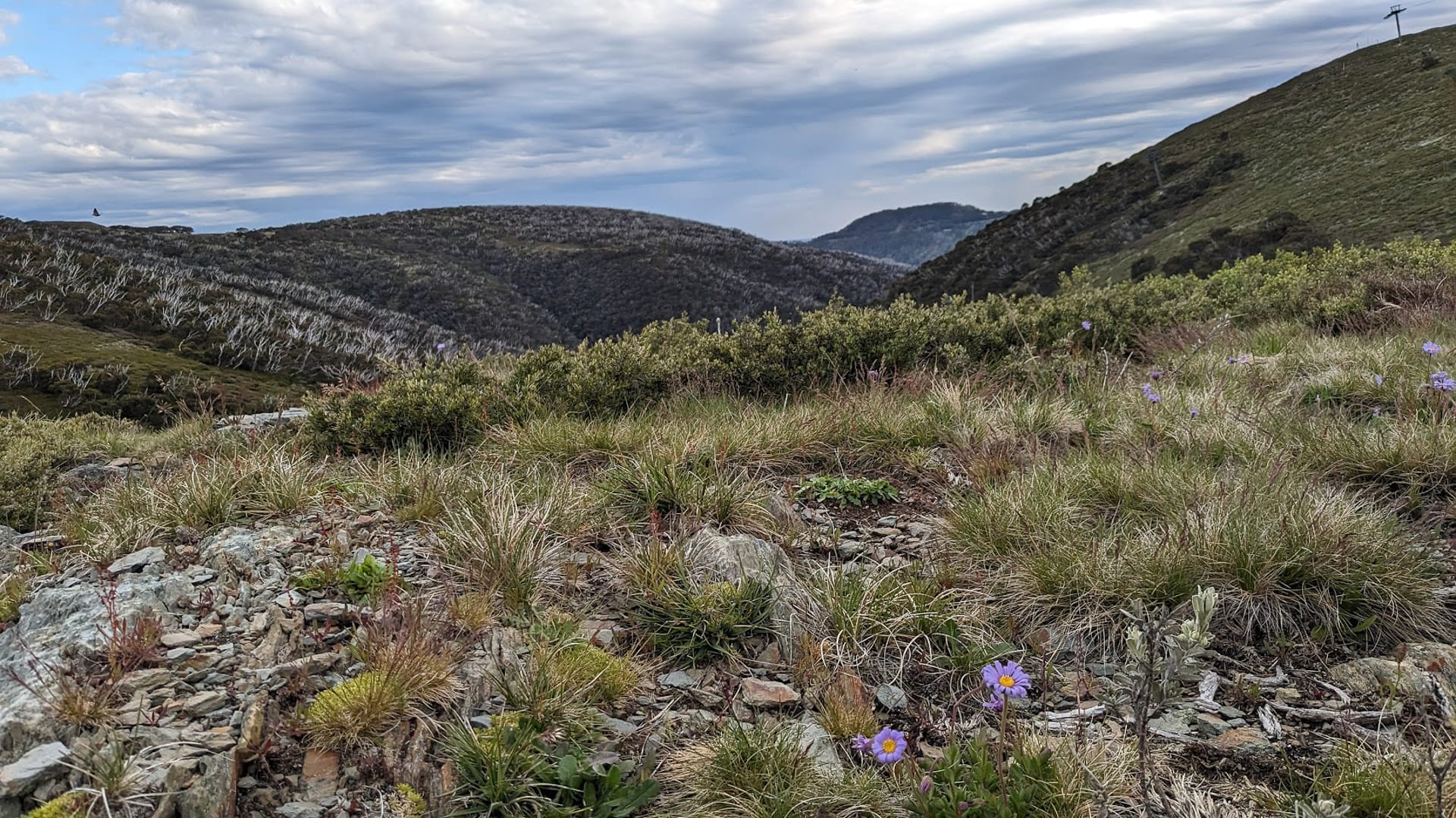
It was at this point that the trail became narrow and it began to feel like a real-honest-to-goodness hike! We picked our way across narrow timber beams, gawked at purple daisies, and took hundreds of pictures that we’ll probably never look at again but seemed warranted at the time.
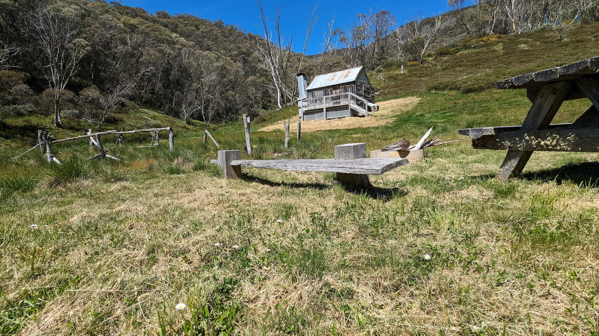
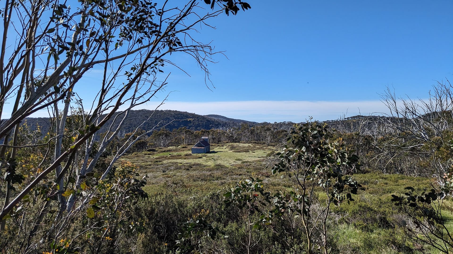
All too soon we reached the turn-off to Derrick Hut, and the trail began to trend downwards. Our walking was nearly over for the day. About 150m from the hut we crossed a tiny little stream.
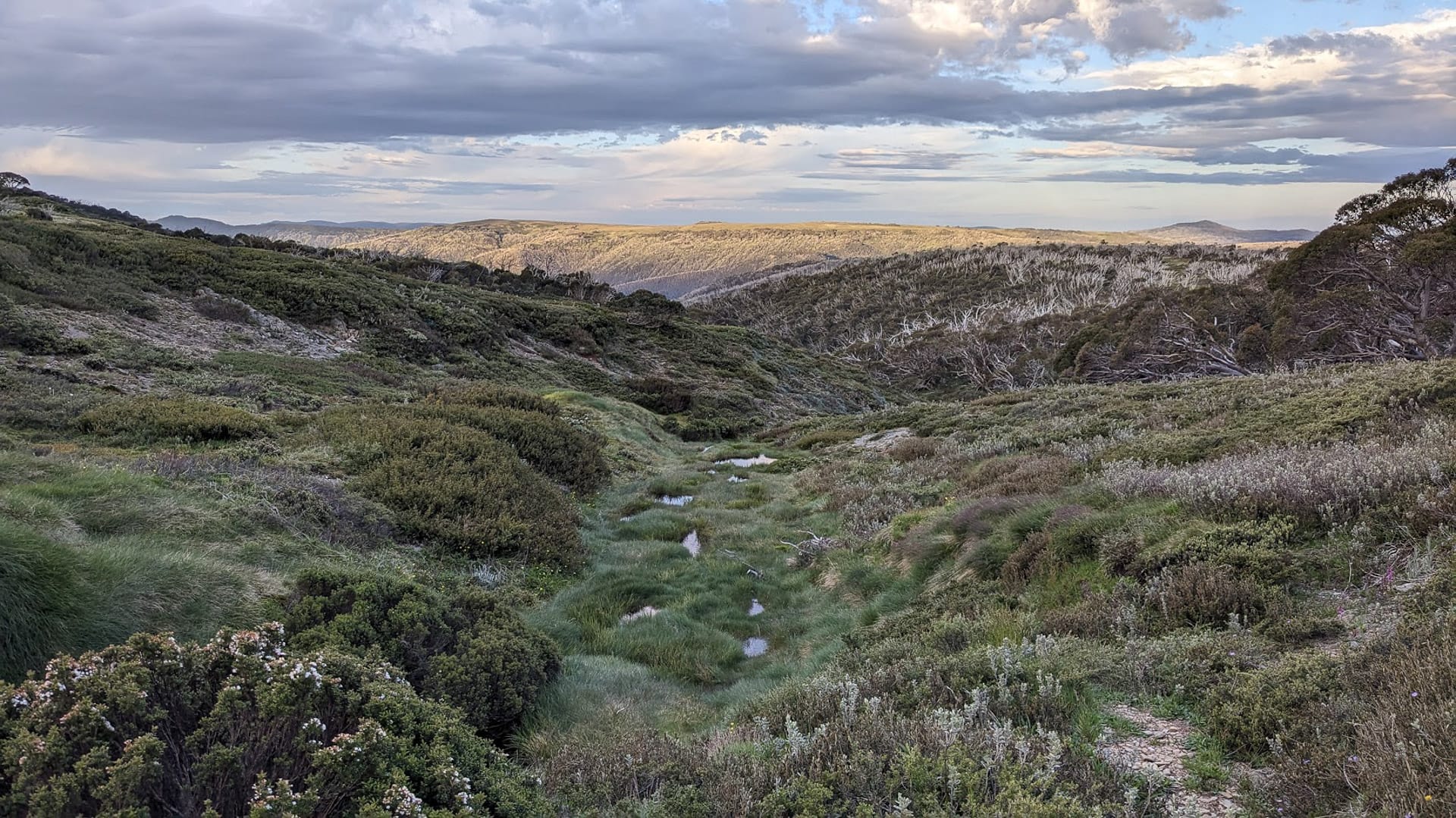
A soak near Derrick’s Hut may offer water
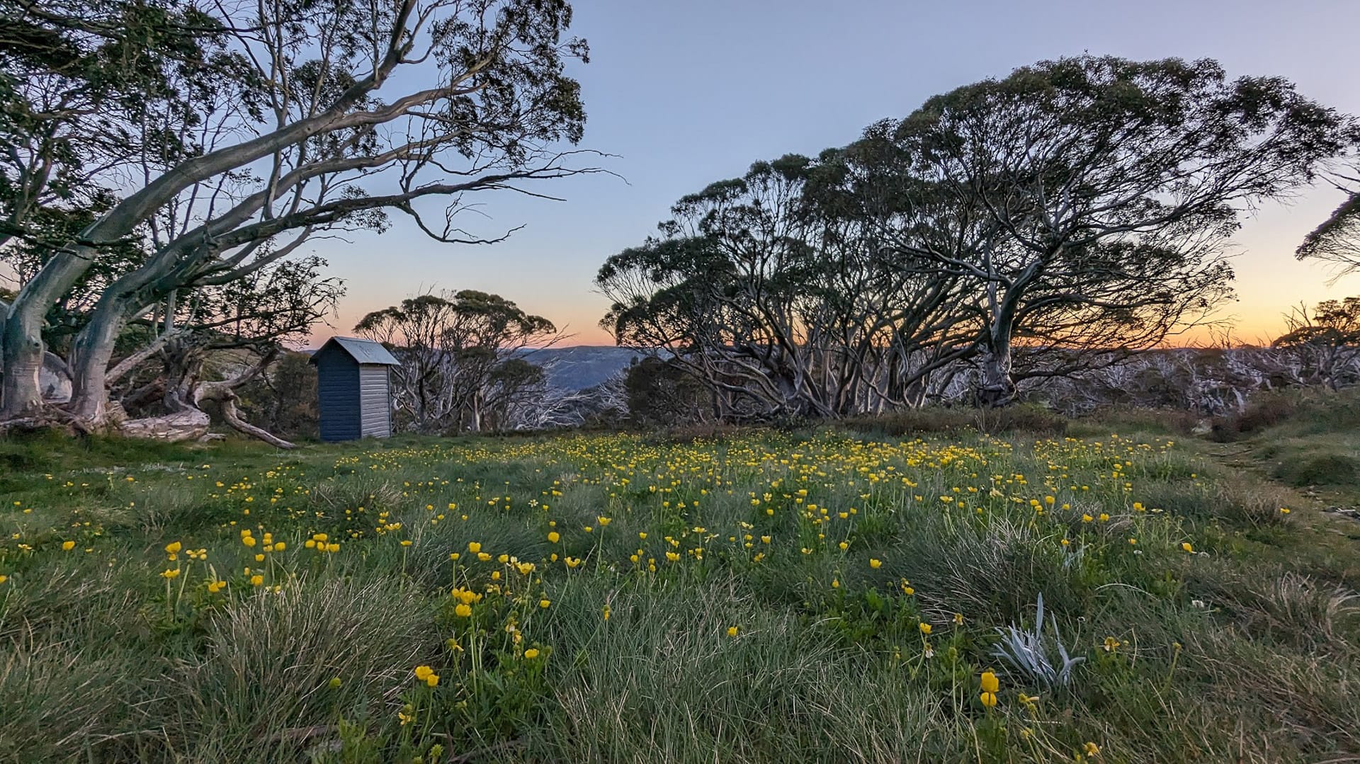
This ‘soak’ appears after heavy rain and is the only place (except for Swindlers Creek at the bottom of the valley on day two) where water can be accessed on the trail. We still had plenty so we hopped over it and continued through the densely packed vegetation, eventually emerging through the scrub to find Derrick’s Hut.
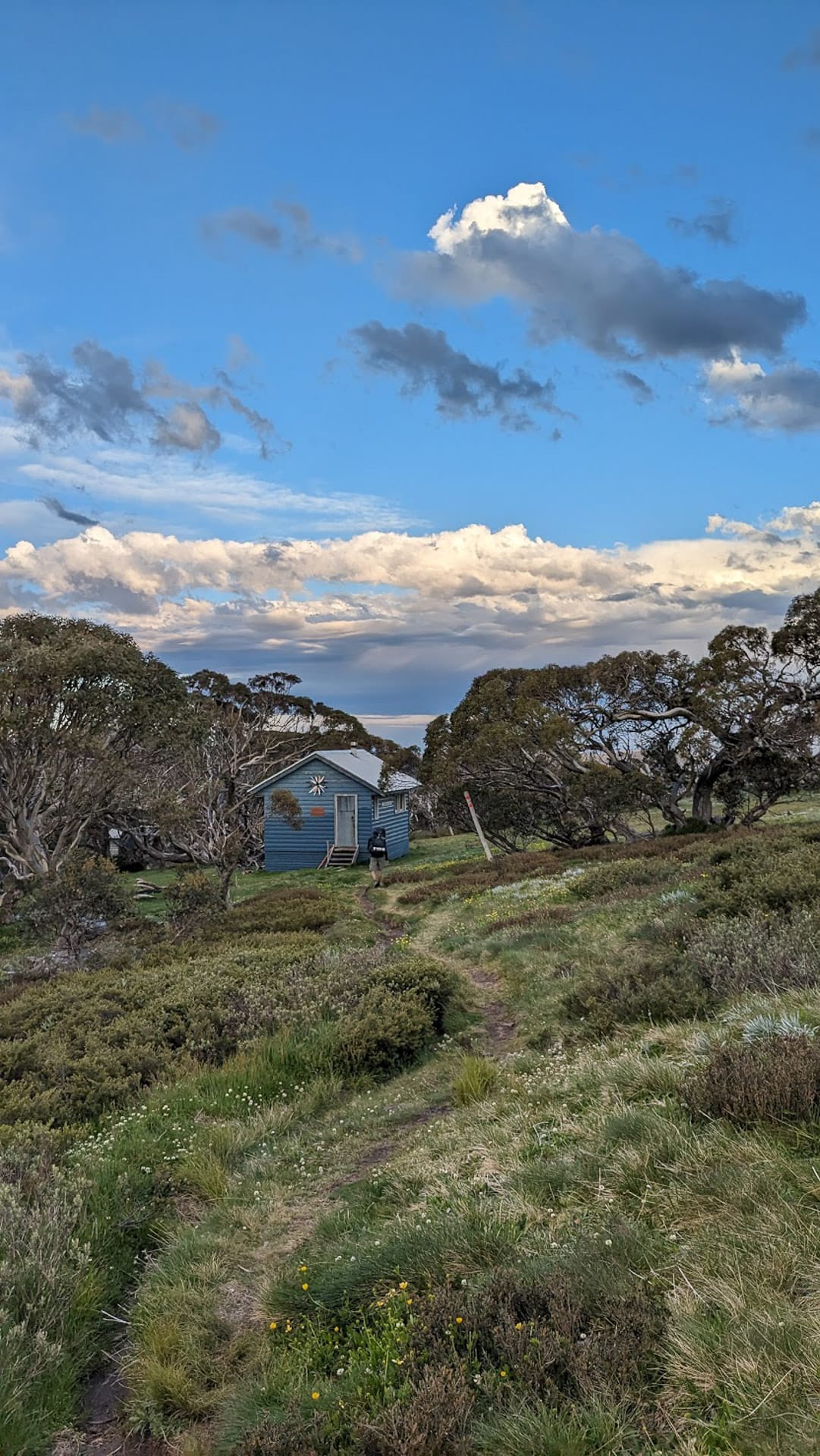
Derrick Hut is surrounded by snow gums
Dreaming at Derrick Hut
Our initial impression was one of awe. We were both speechless at the incredible view framed by the snow gums. Even the view from the loo was great, neither of us even bothered to close the door! We were the only people for miles (surely!) and we weren’t missing a second of that view.
No apologies for the wildflower spam
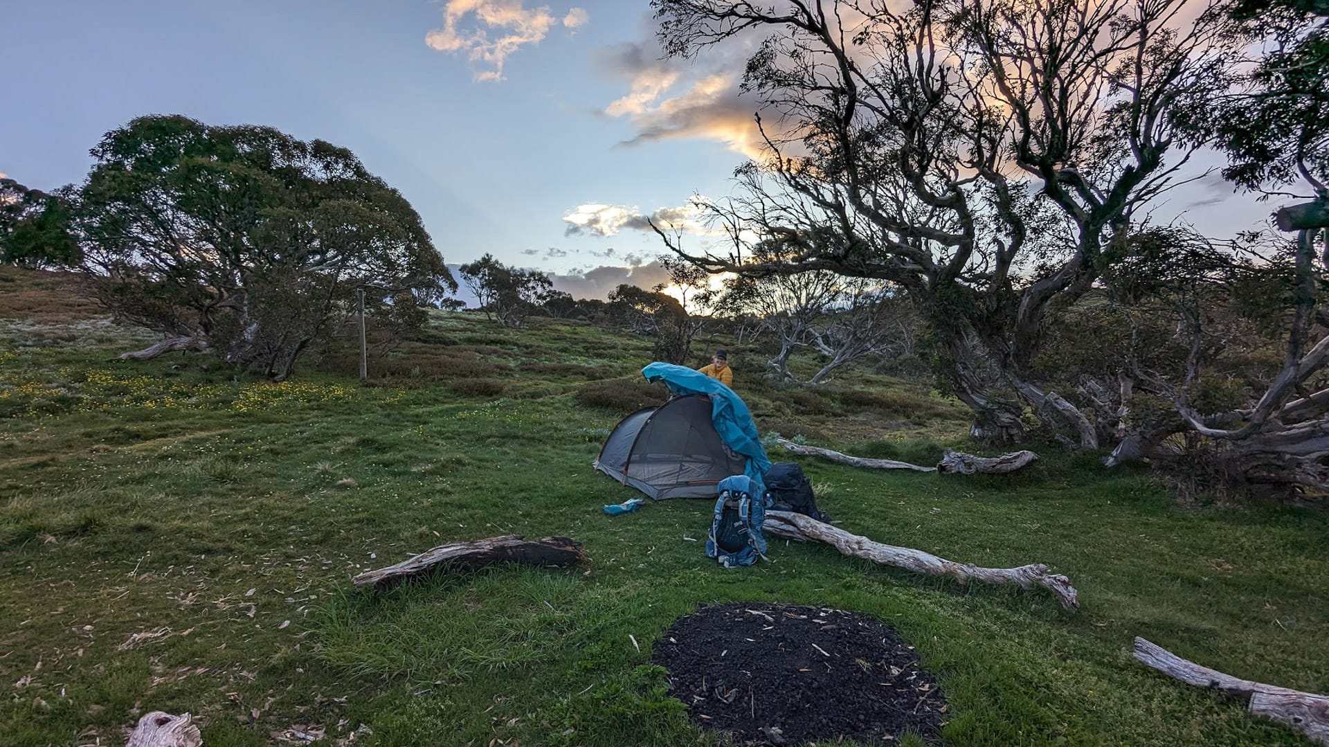
After setting up our tent on the flattest bit of ground that we could find, we set about the usual camp routine of cooking dinner, inflating our sleeping mats, and locating the head torches before we were plunged into darkness. The sun was setting over the mountain behind us so there was no glorious spectacle, but we knew that meant sunrise was going to be something special.
Still not apologising
How right we were! 5am rolled around, and so did two bleary-eyed heads determined not to miss a second of the day’s first rays. Despite the difficulty of dragging ourselves out of our toasty sleeping bags, seeing this sunrise was the highlight of our trip.
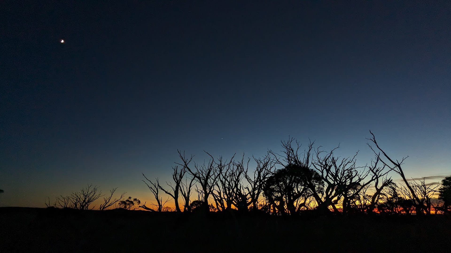
Prepare for a great night of stargazing if it’s clear
A deep red stripe lined the horizon, as if a dragon was about to open an eye and peek into our campsite. More colours followed, even as the moon remained suspended overhead with a few stars for company.
Despite plans to leave at first light, we lingered until 7am, gawking at the sky at every opportunity as we distractedly packed away the tent and munched on muesli.
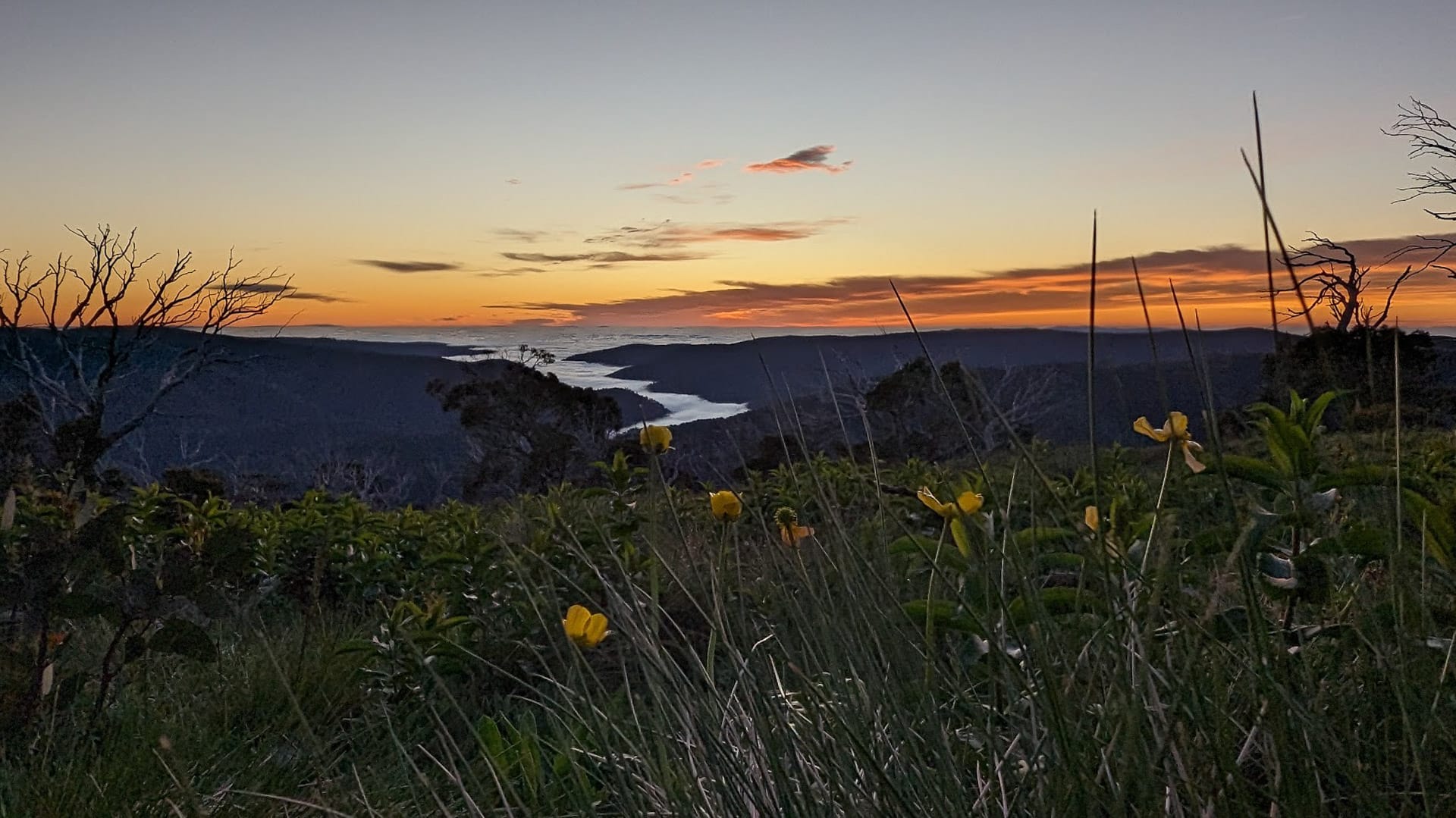
Early bird gets the morning glow up
Derrick to Spargo’s
We slowly left the ridgelines behind, catching glimpses of the clouds lingering in between the mountains like a blanket every now and then. There’s only 2.3km separating Derrick Hut from Spargo’s Hut, but the terrain changes dramatically and you start getting the first significant declines of the hike so far.
An old mining track heads into the valley
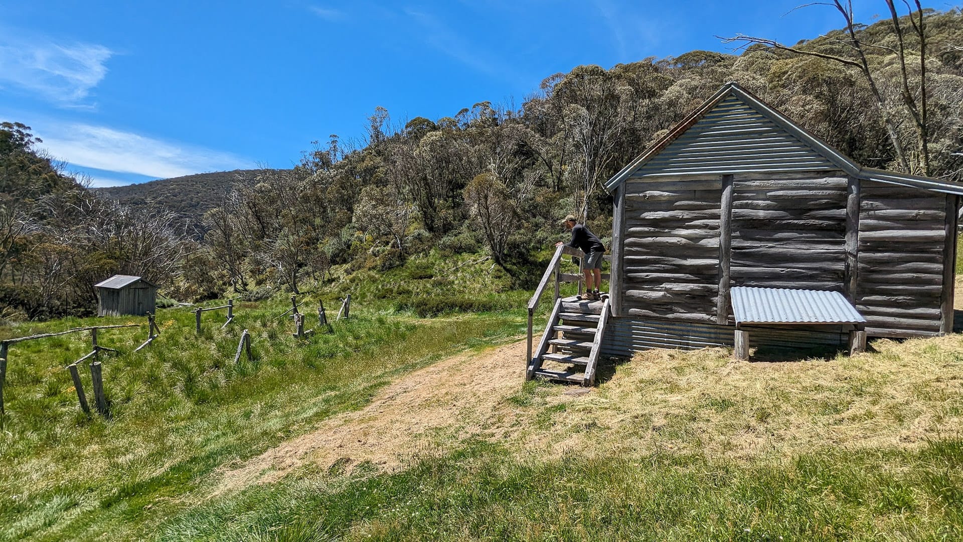
Out of nowhere, Spargo’s Hut pops up in a gorgeous clearing, surrounded by a meadow of flowers. It’s the oldest hut on the trail, has survived multiple bushfires, and is heritage-listed.
Spargos Hut appears almost out of nowhere
Inside the hut, you’ll find lots of old-timey nostalgic items and even a guest book to record your visit. The meadow is a great spot for a break, but if you arrive here outside of early morning or dusk, be mindful that there’s minimal shade.
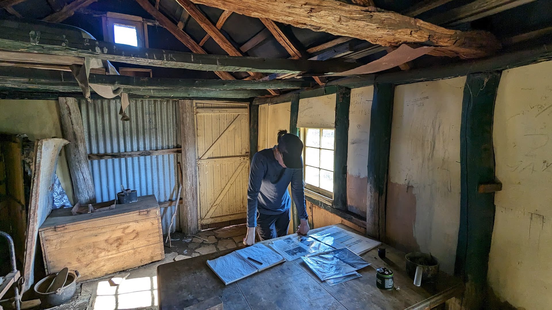
Spargos is the oldest hut on the walk
Golden Point Spur to Swindlers Creek
After Spargo’s Hut, the Hotham Huts Walk turns into a hike. Bust out your gaiters to protect yourself from snakes, reapply your sunscreen, and re-lace your boots. The real work begins now.
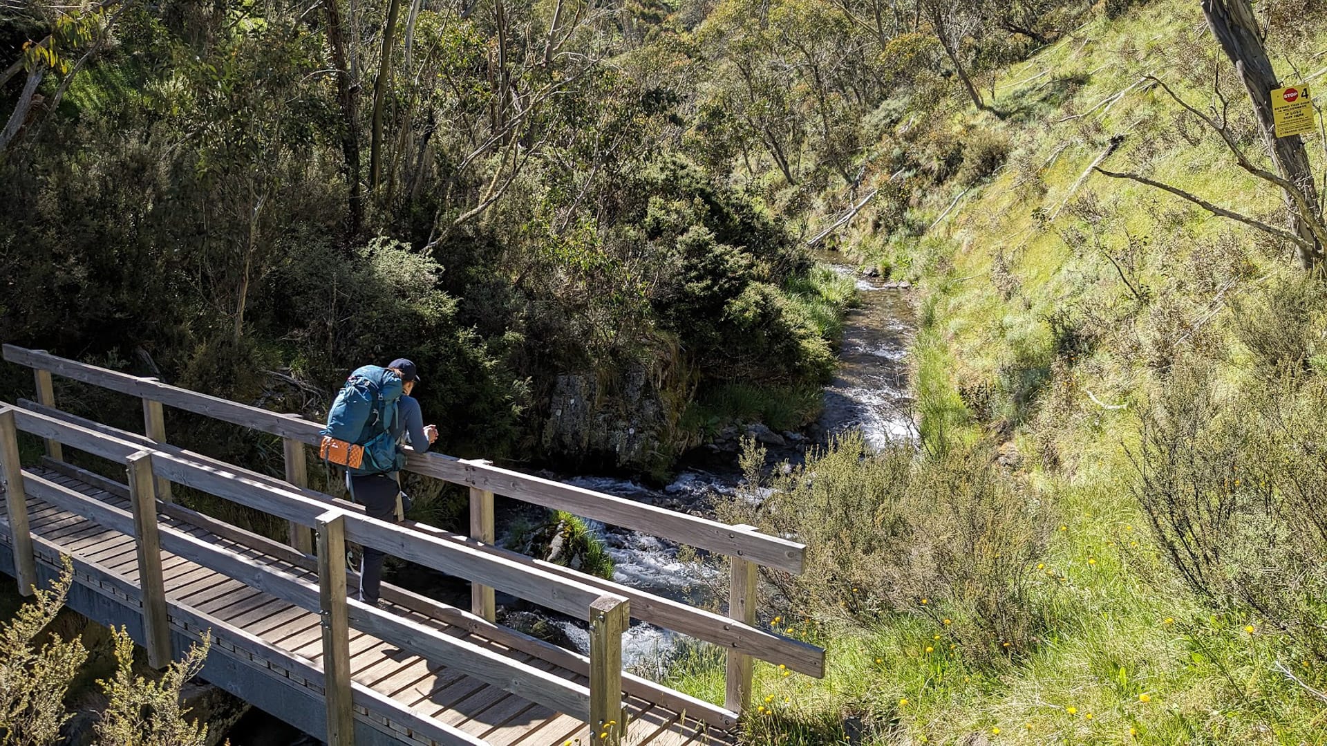
Golden Point Spur is a steep 1.4km descent from the tops of the mountains to the river racing through the ravine at the bottom. The trail is cut into the mountain as a switchback so you can accomplish this section without hiking poles like we did. Our descent was accompanied by the warblings of Currawongs and the occasional butterfly wafting across the trail ahead of us. The sound of Swindlers Creek swelled larger until all of a sudden we found ourselves beside it.
Swindlers Creek deep in the valley
There’s a timber footbridge and two very conveniently placed benches. Never one to miss an opportunity for a break, we happily dropped our packs and enjoyed fifteen minutes to refuel and stretch our legs. If you need to get more water this is the best place to fill up.
Having conquered the downhill sections like true champions it was time for the monster uphill section. This 750m stretch was unrelenting. It was hard. By this time it was mid-morning, the sun was high in the sky and while there were plenty of snow gums, there was minimal foliage to shield us from the heat.
The best part of this section by far was the flowers. They were everywhere. They lined the path, they dotted the shrubs, and daisies swung happily in the breeze. It was the best distraction from the burning of sore muscles.
Cobungra Ditch to Davenport Access Track
Just as I was beginning to wonder if this was all a ruse and I was destined to walk uphill on a neverending circuit forever, the trail flattened out and we were on the Cobungra Ditch Walking Track.
We thought we’d seen all the variety we were going to see but this 1.7km section has it all. Waterfalls, steep valleys, snuggly vegetation corridors, sudden boggy bits, and boulders galore. It was awesome and over way too soon.
It’s nice and flat and a great section to recover and stretch out as you walk. Take the chance to recover – more hills are on their way!
Cobungra Ditch track
Davenport Access Track and Silver Brumby Hut
When we finally emerged onto the Davenport Access Track, we were exhausted. The first day of the Hotham Huts Walk was cruisy and flat and had lulled us into believing that day two would be a similar walk in the alpine park. After 1.5km straight down a hill, and halfway back up again in direct sun, we were pooped.
Silver Brumby Hut
The good news is that Davenport Access Track is another wide gravel path so we didn’t have to watch our feet. Turning right at the junction we headed back down, down, down to the valley floor to check out the final hut of the trail – the Silver Brumby Hut. It was the best one. And we loved it.
It was built right in front of Swindlers Creek, had a great little balcony out the front and strong seating inside so we could escape the sun and rehydrate. The little meadow was a tiny oasis complete with picnic tables and is an ideal spot to aim for to spend some time lounging around.
Silver Brumby Hut Back to Hotham Village
From Silver Brumby Hut it’s all uphill to reach the finish. You have access to Swindlers Creek at the hut so make sure to fill up water if you’re running low as you’ll be needing it before this walk ends.
Multiple people warned me about this final slog up the Davenport Access Track to the Great Alpine Road and I shrugged it off, thinking surely a vehicle access track won’t be that difficult. With a day pack on, I’m sure this section of the track wouldn’t warrant more than a passing comment that it was a bit long, but with an overnight pack… it was hard.