
Whether you crave panoramic views, lush rainforest escapes, a gruelling challenge, or a literal walk in the park, this list of Warburton trails contains a goldilocks hiking track to suit you. � We Are Explorers acknowledge that this adventure...

Whether you crave panoramic views, lush rainforest escapes, a gruelling challenge, or a literal walk in the park, this list of Warburton trails contains a goldilocks hiking track to suit you.
�
We Are Explorers acknowledge that this adventure is located on the traditional Country of the Wurundjeri People who have occupied and cared for the lands, waters, and their inhabitants for thousands of years. We pay our respects to them as the Traditional Custodians and recognise that sovereignty was never ceded.
�
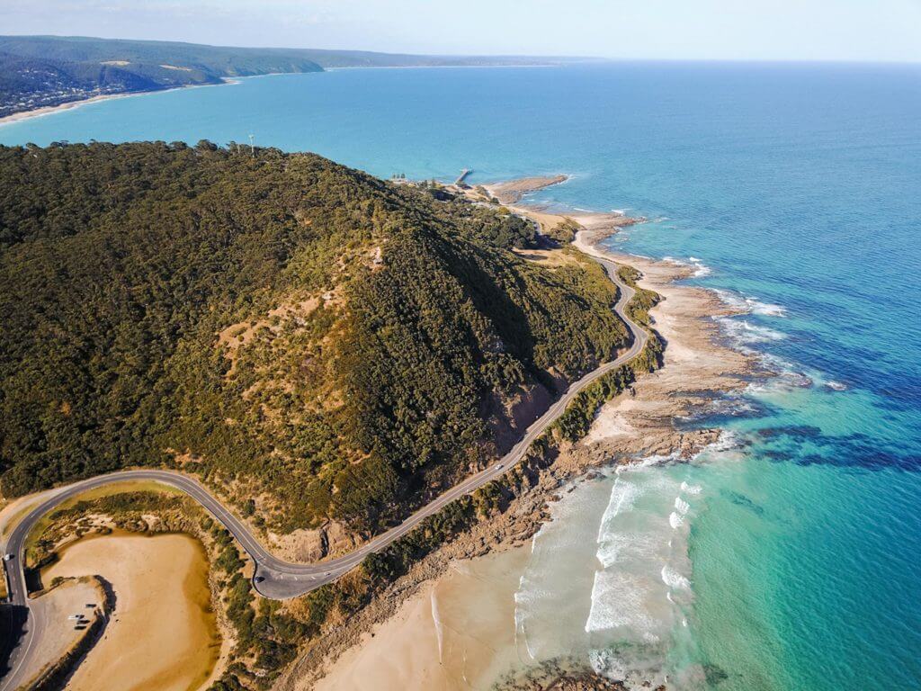
The picturesque town of Warburton located in the Yarra Valley region of eastern Victoria is home to a surprisingly large number of walking tracks and trails, with options for every kind of walker. Only 90 minutes from Melbourne CBD via the M3 and Warburton Highway, the town sits snugly around the Yarra River and is an extremely popular place to spend a weekend in Victoria.
Aside from walking tracks, Warburton is also well known for the annual Warburton Trail Fest, its wholesome weekend markets, great swimming holes, and seemingly endless bridges. Not kidding about the bridges by the way � they are over rivers, in roads, breaking up the path on trails� building a bridge (and getting over them!) is apparently a common activity in Warbie.
What are you waiting for? Make like a local, choose a hike, and plan which bridges you�ll be getting over first.
�

The 13 Best Warburton Trails
1. Mount Donna Buang Summit Hike
Distance: 9km (one-way)
Duration: 7-9 hours (depending on you hill fitness � this time is representative of a fit, seasoned hiker)
Difficulty: Difficult
Toilets: There are toilets available at the summit
Dog-friendly? No
�
�
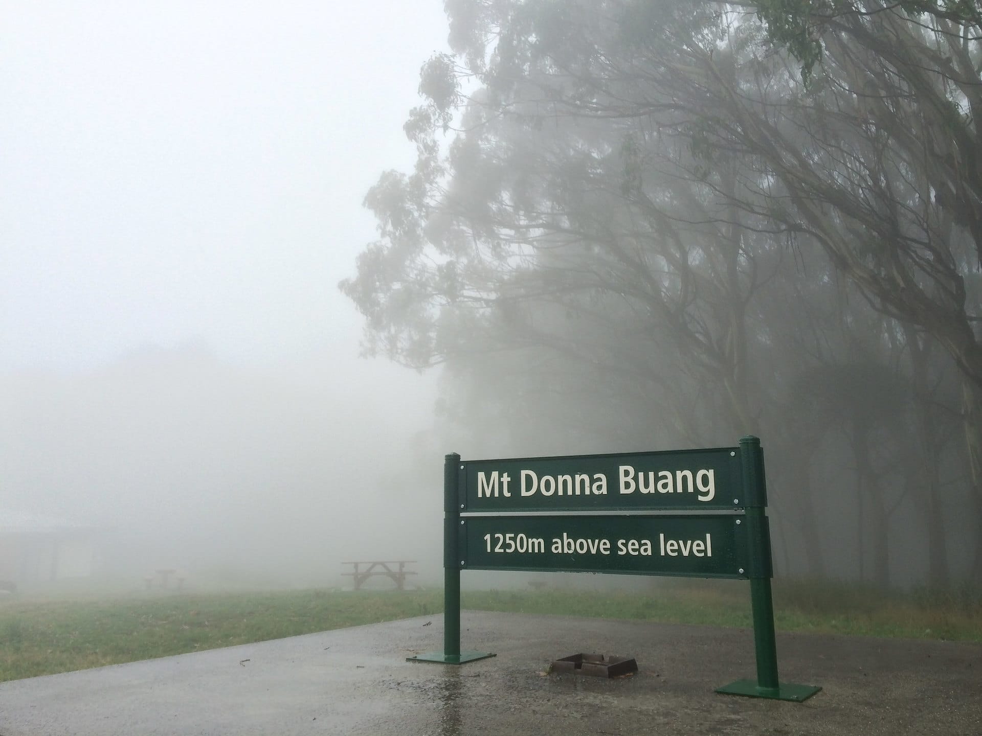
The hike takes you from the town of Warburton to an elevation of 1245m at the top of Mount Donna Buang. The summit has a metal 21m tall lookout tower with a wide platform. On a clear day the view from the top is phenomenal. You can see all the way from the Yarra Valley to Melbourne CBD in one direction and with a slight turn see Mount Baw Baw, Cathedral Ranges and the Alps in the other. Also atop the mountain is a picnic area, small car park, fireplaces, and gas BBQS � everything you need for a post-hike meal!
There are many ways to approach the hike to Mount Donna Buang because you can basically start from anywhere in Warburton or even from the summit itself! This is why you�ll see varying distances for this hike all over the internet. You�re not losing your mind, it�s just that everyone starts in a different place. Every route will involve traipsing to the top of Mount Donna Buang via Martyr Road and the summit of Mount Victoria.
If you want to start up the top, or do a car shuffle so you only walk one-way, there are approximately 20 parking spots up the top of Donna B. If you don�t feel like walking, you can ride your bike up Mount Donna Buang Road instead.
Arguably, this is the best hill climb near Melbourne � it�s gruelling and considered the perfect training ground for hikes like the Grampians Peaks Trail, Larapinta, and the Overland Track. Sure, you�ve got the 1000 steps in the Dandenong Ranges, but this trail at Mount Donna Buang dazzles with varying terrain and more natural inclines.
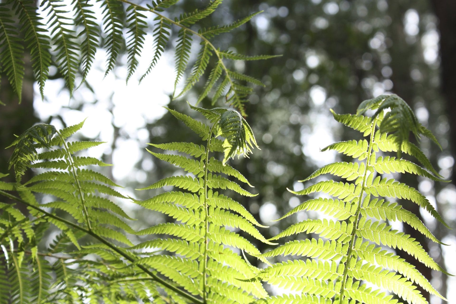
The steep narrow track passes through lush forests with dense canopies overhead and small orange arrows directing your path. Make sure to bring waterproof boots (this beast is muddy basically year round), plenty of layers, and know how to remove leeches should one jump aboard for a ride. If you relish working up a sweat and pushing yourself, strap yourself in for a good day on the trails.
�

2. Rainforest Gallery Walk
Distance: 700m (return)
Duration: 20 minutes
Difficulty: Easy
Dog-friendly? No
�
�
The Rainforest Gallery Walk is on Mount Donna Buang Road and is about a ten-minute drive from Warburton. This walking track is a great one to enjoy on a really hot day when you can�t be bothered driving all the way to the beach, it�s too hot for a long hike, and you�d like to be outdoors. It makes for an awesome day trip when paired with a picnic at the top of Donna Buang.
The temperate rainforest shades you from the heat of the sun and walking really doesn�t get much more zen than this. If you�re lucky you�ll get to enjoy a refreshing breeze rustling through the ancient Myrtle and Beech Trees, some of which are known to be at least 400 years old!
The track starts with 100 stairs leading to an elevated walkway through the trees towards a 40m-long platform that is about 15m above the forest floor. It�s really relaxing to stand there and listen to the sounds of Cement Creek bubbling away below you.
�
3. La La Falls Walking Track
Distance: 3km
Duration: 1.5 hours
Difficulty: Easy to moderate
Dog-friendly? Yes, but dogs must be on a leash at all times
�
�
This gorgeous single track trail to La La Falls follows Four Mile Creek and is best enjoyed after recent rain. You�ll want to wear shoes with sturdy ankle support and good grip as you�ll be crossing stone bridges across the creek and they�re always very slippery.
While the walking track is relatively easy to traverse, it has a constant, steady incline so you�ll need to be fit to enjoy it. Bird life is plentiful and the route provides a great introduction to the beautiful scenery on offer in this corner of Victoria.
The best apart about this trail for dog-lovers is that you can bring your furry pal along too. They�ll need to stay on leash at all times � yes even at the bridges where the photo opportunities are awesome. Please remember to follow leave no trace principles and pick up after them.
If you�re feeling peckish, Gladysdale Bakehouse and Red Relish Cafe are some great dog-friendly cafes near the start of the La La Falls Walking Track that you can visit either before or after you hit the track.
�

4. Mount Donna Buang to Mount Boobyalla
Distance: 2.5km
Duration: 45 minutes (one-way)
Difficulty: Moderate
Dog-friendly? No
�
�
This is a great little walk between two summits. Starting at the Mount Donna Buang summit car park, find the track east of the lookout tower that�s marked �to Dom Dom Saddle�. This will deliver you to Mount Boobyalla a mere 2.5km later. Be careful not to miss the turn off to Mount Boobyalla� it�s a full 21km between Mount Donna Buang and Dom Dom Saddle so you�ll be in for a much longer walk!
While it�s only 2.5km in length, this track is highly variable, both with incline and trail conditions. You�ll spend time on narrow singletrack surrounded tightly with ferns and shrubbery. But you�ll also have sections of track that are wider, with evenly graded gravel.
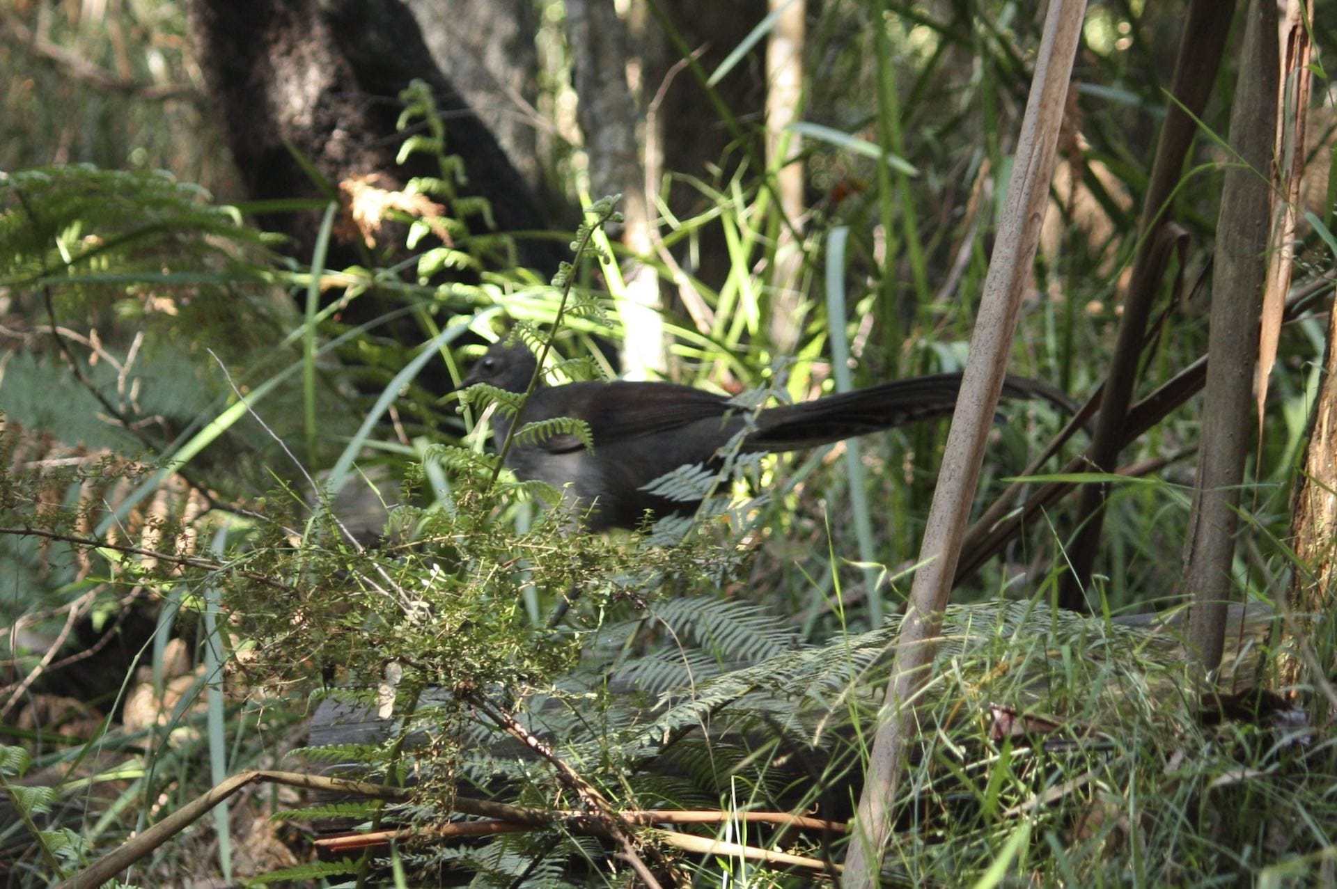
The drive along Mount Donna Buang Road to the summit picnic area and car park is incredibly scenic � so try to get someone else to drive or drop you off so that you can enjoy looking out the window. If you�re lucky, you�ll spot lyrebirds if you�re visiting in the cooler months.
�
5. Mount Donna Buang to Dom Dom Saddle Walking Track
Distance: 21km (one-way)
Duration: 8-10 hours (one-way)
Grade: Difficult
Dog-friendly: No
Toilets: Yes, at Mount Donna Buang (the toilets at Dom Dom Saddle picnic area are permanently closed)
�
�
Starting at Mount Donna Buang, look for a track leading away from the car park directly east of the summit lookout tower that�s marked �To Dom Dom Saddle�. This is the track that you�ll be following for a tough 21km.
The route to Dom Dom Saddle has multiple steep climbs, which will reward you with panoramic views at the top of Mount Boobyalla, Mount Vinegar, and The Knobs.
On top of being difficult, this track isn�t consistently well marked and as such is only suitable for fit and experienced bushwalkers who are comfortable with navigating the frequent short distances where the track is ambiguously signed.
Read more: Navigating With a Map & Compass
�

6. Mount Donna Buang to 10 Mile Turntable Walk
Distance: 1.4km (one-way)
Duration: 45 minutes (one-way)
Grade: Easy � moderate
Dog-friendly: No
Toilets: Yes
�
�
The Ten Mile Turntable Walk begins at what is effectively a winter overflow car park � 10 Mile Turntable � and takes you to the summit of Mount Donna Buang. Along the way you�ll be walking amongst beautiful scenery including tall snow gums, vibrant green moss, and the occasional lyrebird.
Get started by walking back down the road, away from the car park for about 20m. Turn onto the track that appears and follow it about 400m uphill until you reach a track junction. Turn left and follow the remainder of the trail through lush eucalyptus forest until you reach the summit.
After climbing the lookout tower to enjoy the stellar views (fingers crossed you get a clear day and not the wall of fog that I experience last time I did this!) you can head back the way you came.
This is the easiest version of this walking track but technically there�s another way that you can return to your car, using the old road beside the toboggan run. I tend to avoid this particular route because it involves climbing a gate, but I�m mentioning it in the spirit of giving you the complete picture.
�
7. O�Shannassy Aqueduct Trail
Distance: 34km (one-way)
Duration: Two days
Grade: Easy (partial length) � moderate (full length)
Dog-friendly: Yes, but only on this section and dogs must be on lead at all times
Toilets: No. The closest toilet block is in Warburton
�
�
The O�Shannassy Aqueduct Trail follows the access track to the aqueduct that supplied water to Metropolitan Melbourne for 82 years before it was decommissioned in 1996. It essentially mirrors the path of the Warburton to Lilydale Rail Trail, but is set further back into the mountain and is a lot more scenic.
The Aqueduct Trail, which connects East Warburton to Don Valley in the Upper Yarra Valley, is gently undulating and suitable for people of most fitness levels. For the same reason, it�s popular amongst cyclists and people with prams, rollerblades, and skateboards.
You don�t have to tackle this walk in one go as there are plenty of places you can access it along the 34km. The most common starting point is at the Dee Road Car Park in Millgrove. The 7km between Dee Road Car Park and Yuonga Road Car Park in Warburton are the only part of this walk that is dog-friendly, provided doggo remains on a leash.
�
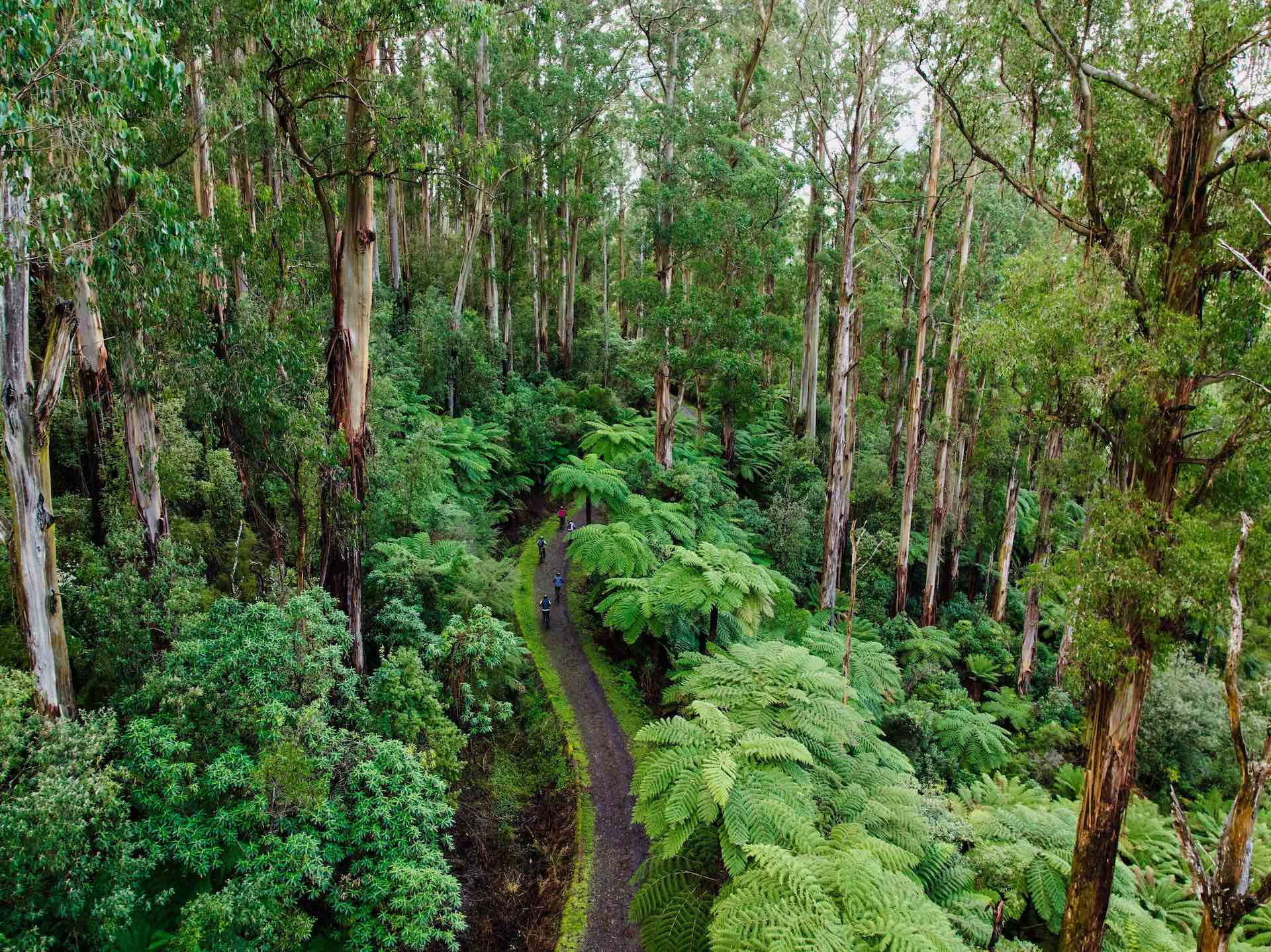
Image thanks to Warburton Adventure Co
8. Warburton River Circuit Walk
Distance: 5km (loop)
Duration: 2 � 3 hours
Grade: Easy
Dog-friendly: Yes, but dogs must be on lead at all times
Toilets: Yes. There are plenty to be found in the township of Warburton
�
�
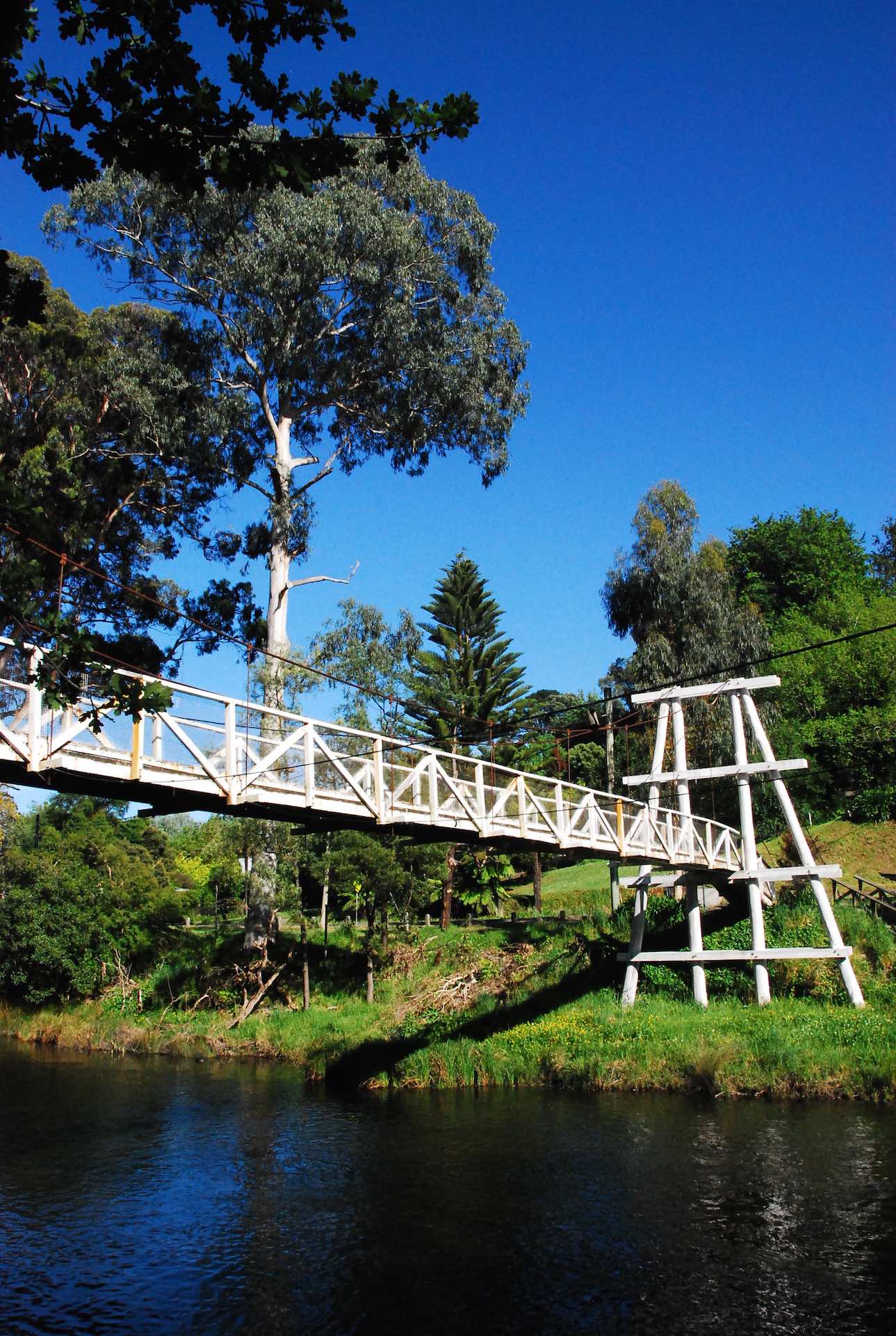
The Warburton River Walk starts and finishes in Warburton Main Street and utilises a path that extends to both sides of the Yarra River.
While you can technically start anywhere along the loop between Mayer Bridge and the Signs Bridge (more often called the Highway Bridge!), the most common starting point is at the historic swing bridge over the Yarra River. There are four bridges behind the town that cross the river but you�ll know the swing bridge when you see it!
If you get confused, keep an eye out for one of the many information boards along the route, which provide maps along with interesting tidbits! And if you get really confused and would rather spend your time enjoying your day rather than squabbling over directions (this happens more often that you�d think� is the Warburton River Walk the Ikea equivalent of hiking trails?), make sure you pack a picnic so you can utilise one of the many prime picnic-ing locations dotted along the circuit.
This is one of the most beautiful places to enjoy the Yarra River and it�s reliably clear as it bubbles across the rocks. Every local will tell you to plan your trip to Warburton carefully as it�s very popular and parking along the main road can be difficult. Weekdays are your best bet for securing a parking spot, but if you�re headed there on a weekend, just aim to get there early or to walk a little further than anticipated.
Note: You�ll sometimes see this walk referred to online as the 6km Yarra River Walk. It�s the same walk � the extra distance comes from walking down some side tracks and across each bridge and back.
�
9. Lilydale to Warburton Rail Trail
Distance: 40km (one-way)
Duration: 2-4 days (walking)
Grade: Easy
Dog-friendly: Yes, but dogs must be on lead at all times
Toilets: Yes. Public toilets are available at both ends of the trail
�
�
Beginning at Lilydale Station and ending in the Warburton township, the Warburton Trail is exceptionally popular for cycling. The gentle grade makes it the perfect place for a day trip with the family. Want to cycle but don�t have a bike? The Cog Bike Cafe in Warburton has everything you need, including excellent coffee!
At only 40km, it�s easy to cycle the entire length (and return!) in one day, but most walkers will need multiple days to cover the whole trail. Highlights of this popular Yarra Valley trail include passing through farmland, vineyards, restored bridges, and old train station platforms.
If you like history you�ll definitely want to stop in at the Upper Yarra Museum. It�s conveniently located at Yarra Junction on Maroondah Highway at an access point to the Lilydale to Warburton Rail Trail.
�
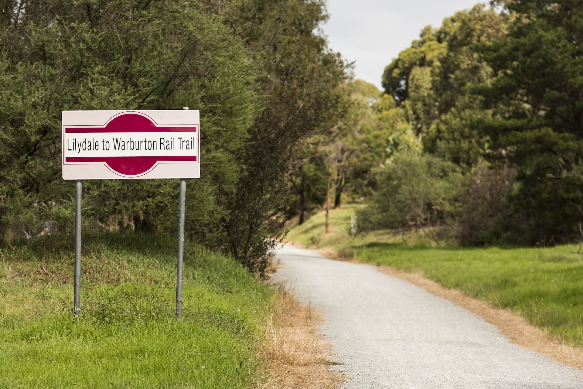
Image thanks to Warburton Adventure Co
10. Californian Redwood Forest Loop Walk
Distance: 1.9km
Duration: 1 hour
Grade: Easy
Dog-friendly: No
Toilets: None
�
�
Only a ten-minute drive from Warburton, the Californian Redwood Forest Walk in the Yarra Ranges continues to grow in popularity.
While this walk is a loop, you can wander beneath the canopy and there are plenty of picnic spots to enjoy good food and great views at the same time. Kids love running amongst the trees, and will be amazed by the giant �dragon�s nests� and sculptures crafted out of branches dotted across the forest floor. Even as an adult I get a lot of joy out of them.
�
�
The Californian Redwoods (Sequoia sempervirens) were planted around the 1930s and many are now in excess of 50m tall. Their presence is immense, creating fantastic channels for light rays to filter through. For this reason you�ll almost always come across photographers trying to catch the perfect shot, or find people snug at the base of a tree, the suns rays perfectly illuminating the pages of the book they�re reading.
The loop walk begins at Cement Creek Road and partially follows the creek. There�s something really magical about this forest. Every time I visit there is a different vibe based on the other people who are visiting. Sometimes it�s filled with children�s laughter as they place hide-and-seek among the trees. Other times it�s silent with people walking irreverently, necks craned in awe as they try to see the top of each tree.
�
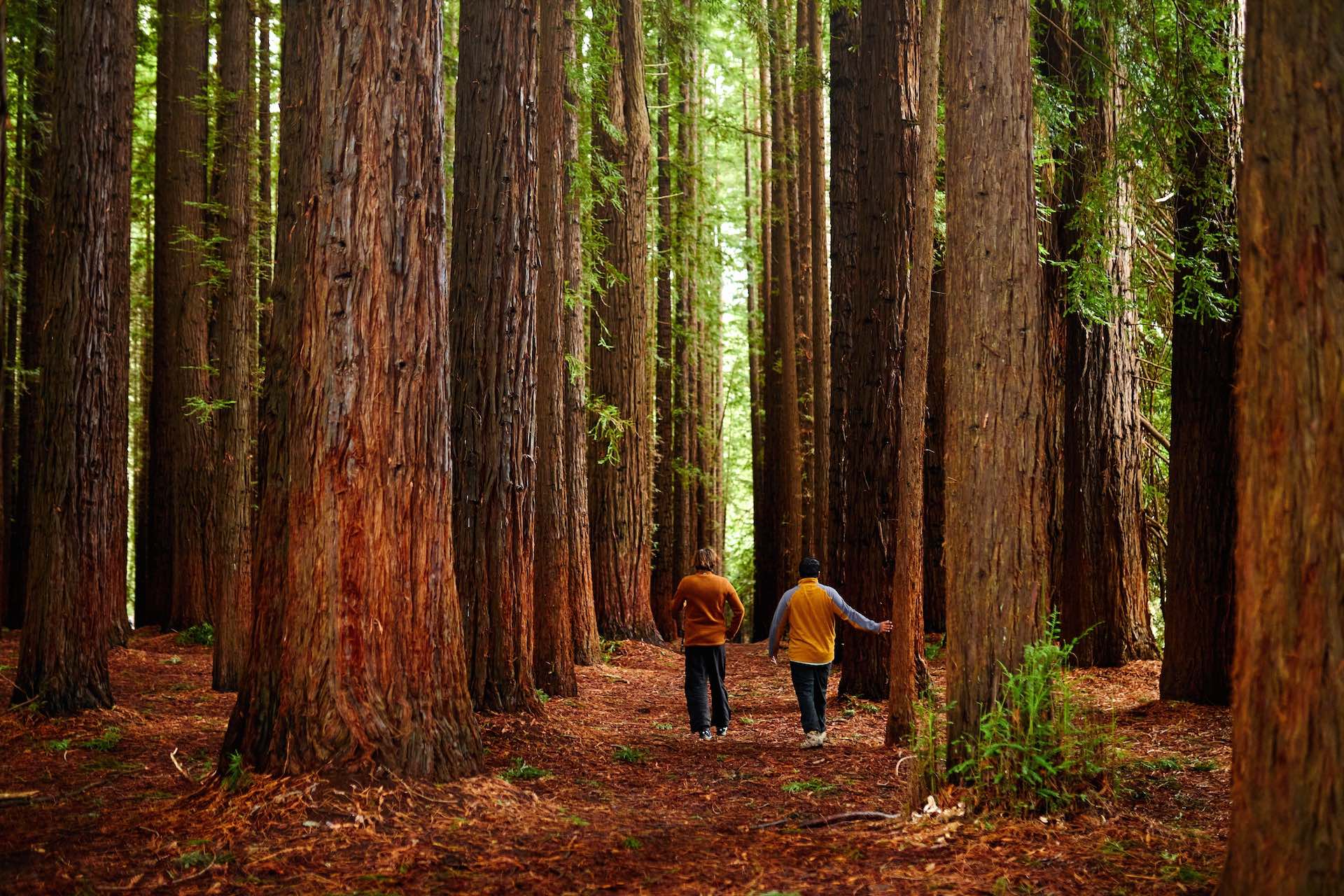
Image thanks to Warburton Adventure Co
�
Note: Access to the Redwood Forest has been limited via Cement Creek Road due to a landslip on the Warburton Highway, but works should be completed in early 2024. Visit the Parks Victoria website for updates on when this beautiful trail will be accessible again. Alternatively, you can access the forest via the significantly longer route using O�Shannassy Aqueduct Trail as detailed below.
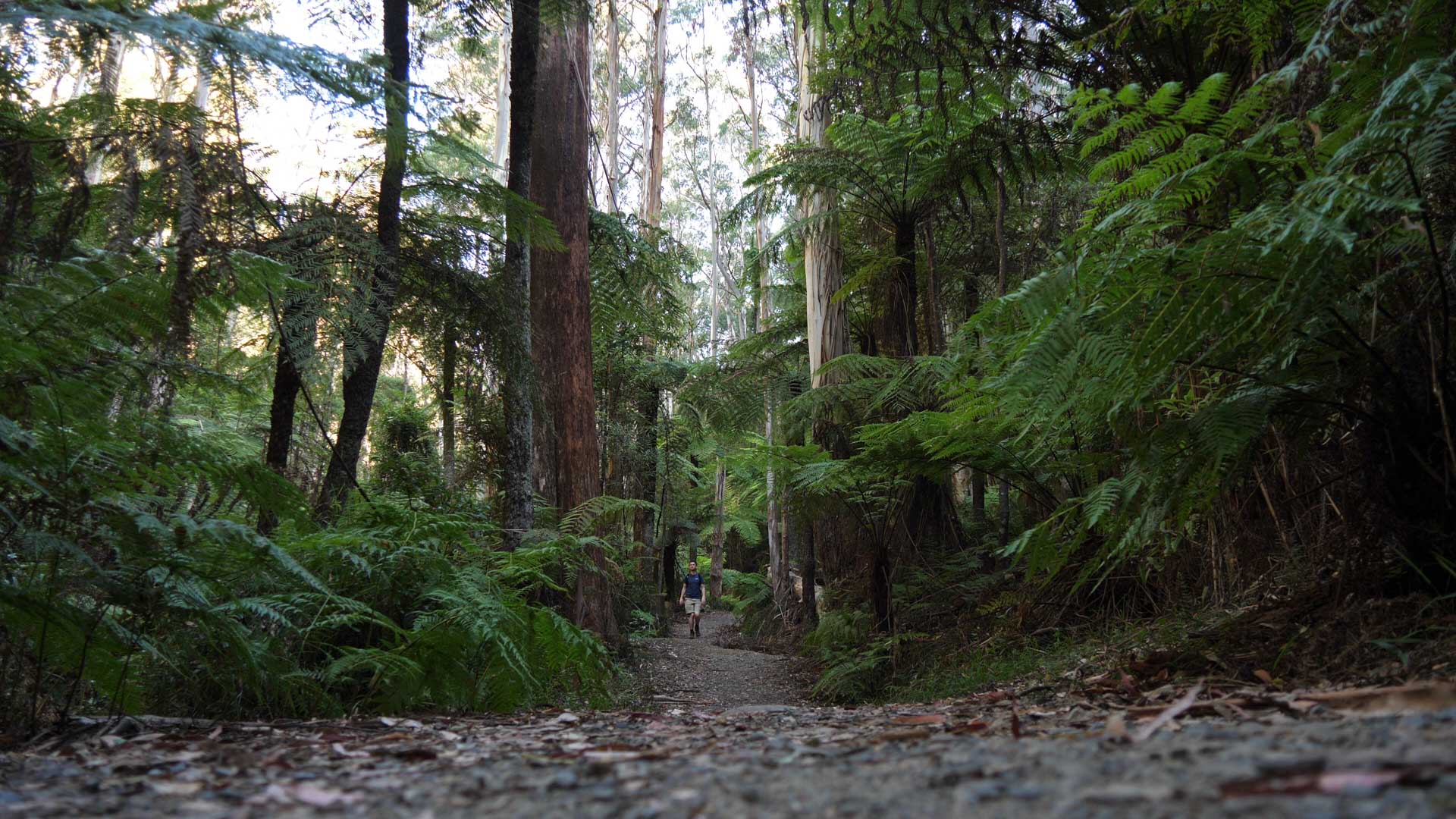
11. The O�Shannassy Aqueduct to Californian Redwood Forest Trail
Distance: 16km (return)
Duration: 2 hours (each way)
Grade: Easy
Dog-friendly: No
Toilets: None. The closest toilets are in the Warburton township
�
�
This is the scenic way to get your happy little hiking feet to the Californian Redwood Forest. While you can also access the forest via Cement Creek Road, this one involves a longer track and you�ll feel like you really earned it when you arrive.
Consider yourself warned that this track has no toilets or facilities, and there are none waiting for you at the Redwood Forest end either. The track itself is undulating, unsealed, and often muddy. Make sure to take enough food and water for the day and let someone know what your plans are as phone reception isn�t guaranteed.
You can jump onto the O�Shannassy Aqueduct Trail at the Yuonga Road Car Park area, which is only a five minute drive from the Warburton Waterwheel Visitor Information Centre. Parks Victoria has done an awesome job putting extra signage along the train to the Redwood Forest so it�s super easy to navigate. If you get stuck, or are navigationally challenged at the best of times like me, you might find this blow-by-blow guide useful.
�

12. Dolly Grey Park Loop Walk
Distance: 2.5km (return)
Duration: 1.5 hours (return)
Grade: Easy
Dog-friendly: Yes
Toilets: None. The closest toilets are at the Waterwheel Information Centre
�
�
This is a pretty basic trail from the centre of Warburton to Dolly Grey Park, nearby. From the Warburton Waterwheel Visitor Information Centre, start walking along the Warburton Trail towards Melbourne. When you reach the old railway bridge, cross over and turn left immediately. The track here is mostly boardwalk. Once it ends, you�ll soon reach a junction where you�ll follow the Backstairs Track uphill to the right. Not long after that you�ll turn left into Dolly Grey Park.
The park itself is quite small and unassuming, but it does have a little waterfall and picnic tables. This is a dog-friendly walk, but it�s quite long for those with four legs so don�t forget to bring water and a bowl for them. If it�s a hot day waiting until you reach the waterfall for them to have a drink is a bit of a stretch. Once you�ve had your fill of Dolly Grey park, you can head back the way you came.
13. Backstairs Track
Distance: 10km (return)
Duration: 4 hours (return)
Grade: Intermediate � difficult
Dog-friendly: Yes
Toilets: None. The closest toilets are in the Warburton township
�
�
As you might have already begun to notice, a lot of the walking trails in Warburton are a little incestuous. By that, I mean that they have a lot of overlap and many of the �trails� are really just multiple tracks joined together or linked in a slightly different way. This Backstairs Track is a prime example. It joins the Dolly Grey Park Walk to the La La Falls and Warburton River Circuits to form a �new� trail that begins from the Waterwheel Information Centre.
If you�re a keen hiker with great fitness, combo trails like this are a great way to tick off a number of great short walks in one go. For this one, you want to follow the directions to Dolly Grey Park provided above, but instead of turning into the park, you�ll continue along the Backstairs Track until it hits the Old Warburton Road. Turning left, you�ll follow this for 3.5km, which will deliver you to La La Falls. After completing the La La circuit, follow La La Avenue downhill towards Warburton. Turn right at Park Road, left onto the Warburton Highway, and arrive back at the Waterwheel.
The easiest part about this path is that if you�re unsure about directions you�re literally starting at a Visitor Information Centre. Head inside before you set out and the staff there can answer your questions.
�
FAQs Warburton Trails
Where can I get more information about walking trails in Yarra Ranges National Park?
Parks Victoria has provided this useful brochure with a short summary of the most popular hiking trails in Yarra Ranges National Park, which includes Healesville, Mt Donna Buang, and Warburton.
What�s the toughest Warburton Trail?
The most difficult Warburton trail is definitely the one up Mount Donna Buang via Warburton. Starting from the Warburton township you climb to the upper reaches of the mountain via Mount Victoria. Total climbing for the ascent is approximately 1170m.
Where does the Warburton Trail start?
The Warburton Trail, or Lilydale to Warburton Trail begins at Lilydale station and ends in the Warburton township.
Is La La Falls dog-friendly?
Yes! This is a great trail to take your pooch on, provided you keep them on leash. After your walk you can hit up the nearby dog-friendly Gladysdale Bakehouse or Red Relish Cafe for some delicious snacks.
Is parking easy in Warburton?
Finding a parking spot in Warburton can be difficult, but it�s not impossible. If you can�t find any parks on Warburton Highway, try Dammans Road, including the side streets.
Is there a caravan park in Warburton?
Yep. For budget friendly accommodation including spots for tents and caravans, you should give the Warburton Holiday Park a visit.
Can you fish in the Yarra River?
The Yarra River is great for fishing. You can expect to catch brown trout between Warburton and Launching Place and Blackfish above Warburton. The Victorian Fisheries Authority has more information if you�re visiting for fishing.
Want more hikes near Melbourne?
Four Hidden Hiking Gems in Melbourne�s Outer-East
Sugarloaf Peak � The Sweetest (And Toughest) Hike Near Melbourne
Boulders And Bunyips at Four Brothers Rocks in Bunyip State Park
�
Table of contents photo by @rcoxxie via Flickr