


In the Levy & Campaign system, players conduct operational campaigns subject to transport, supply, and logistical constraints of the geography. In this article, the designer dives into the Epipolae (P500) map design, and the supply and route constraints of...

In the Levy & Campaign system, players conduct operational campaigns subject to transport, supply, and logistical constraints of the geography. In this article, the designer dives into the Epipolae (P500) map design, and the supply and route constraints of ancient Sicily. All map art is prototype playtest art, and not final.

The Setting: Ancient Sicily

Please take a moment to examine the playtest map of ancient Sicily. Observe the seas, the plains, and hills, and the imposing and sacred presence of the volcano Mount Etna. See the towns and cities and imagine the bustling marketplaces, agora, and temples. Notice how locations are connected by Trackways (brown paths), Waterways (white paths), and Mixed ways (sandy paths). The Trackways of the rural farmers, shepherds, and merchants curve through the hills and countryside. Imagine the traffic on the Waterways: small fishing boats returning to port after a day of hauling nets, and a few larger trading vessels transporting grain, olive oil, and wine bound for Greece.
By 415 BCE, Sicily had long been populated by native Sikels and Sikans, but also had been colonized by Phoenicians (mostly along the West coast of Sicily), and Greeks (mostly along the East coast of Sicily) for hundreds of years. It was a bustling island dotted with cities of diverse peoples that were often in conflict over its fertile territory and its wealth of natural resources.
Now that we have transported ourselves back in time, let’┐Įs consider where and how the cities, farms, and roads span the geography of the island to connect these peoples.
Cities

In Epipolae, Athenian and Syracusan territory is not demarcated by borders, instead initial territory is indicated by the color of each city (blue for Athenians, red for Syracusan, gold for Phoenicians, otherwise neutral [pale yellow]). Phoenician settlements (gold) are enemy to both sides, and cannot be used to trace a supply route. A city that is not enemy or friendly, is neutral. A supply route can trace through neutral locales that are not occupied by enemy forces.
Cities with an anchor are Seaports, which affect supplying and sailing. For these purposes, all Seaports can be considered directly connected to each other as if by Waterway except during Winter.
For example, Moyta is a Phoenician Seaport of size 2.
Estimating City Sizes
In game terms, city sizes correspond to the population count, the defending strength of city walls, the size of the defending garrison, and the assets within the city (which can turn into spoils of war for would-be conquerors). To estimate the sizes of ancient Sicilian cities, academic literature was consulted.
In 1886, Beloch estimated that the Greek population of Sicily in 415 BCE was approximately 600 thousand, on the basis of estimating each city population on reported army sizes (e.g., numbers of hoplites referenced in the ancient sources) [1]. In 2000, Franco De Angelis estimated the size of eleven major cities in ancient Greek Sicily between 1.2 ’┐Į 1.5 million people, on the basis of estimated territory suitable for agriculture and the amount of agricultural land required to support a person.[2] In 2000, ’┐ĮAn Inventory of Archaic and Classical Poleis’┐Į (edited by Hansen and Nielsen) culminated a decade long research project to catalog every Greek city, including statistics on territory size, dates of colonization and destruction, the presence of city walls, fortifications, temples, theaters, and other useful data.[3] In 2006, using the ’┐ĮShotgun Method’┐Į Hansen estimated the population of cities using archaeological evidence of the physical size of each city (based on the area enclosed by the city walls) and an estimate of the population density (based on estimates of habitable area, households per hectare, and average size of each household).[1]
In particular, the De Angelis and Hansen estimates were the basis of assigning each location a city size. In game terms ’┐Į assigning a value between 0 and 3, and designating supply sources. All errors are the designer’┐Įs.
Supply Sources
During the Athenian Expedition to Sicily, the initial Athenian force included over 5 thousand hoplites, over a thousand skirmishers, and 134 Triremes (each with a crew of 200 men). The Syracusans had roughly an equivalent number of hoplites, 1200 cavalry, and 100 Triremes. That is a lot of mouths to feed.
In order to feed these armies, Provender is needed. In this case: grain, bread, oil, water and wine, fish and meat, milk and eggs, fruit and vegetables. Whatever food was seasonally available, and either fresh, or preserved for shipping in large ceramic shipping containers called Pithos or Amphora. In this ancient era, excess food for export typically made its way to the closest port where it shipped by sea.

Historically, Athens imported large quantities of grain from abroad, primarily from the Black Sea. A strong motivation for the Sicilian Expedition was the desire of Athens to secure the large grain supplies across Sicily, of which their ally Leontinoi was a producer.
All supply sources on the map are marked with a Cornucopia and decorated with illustrations of farms. Supplies are moved using Transport along Ways.
For example, Leontinoi is an Athenian ally (indicated by the light blue) and is a Supply Source, indicated by the Cornucopia.

The Athenians have two supply sources: Leontinoi in the East, and Segesta in the West. Both are land-locked, so an immediate concern of the Athenians when the expedition arrives is securing their supply lines and making sure they have access and transport to one or both of these supply sources. If the Athenians cannot secure their supply, they’┐Įll need to rely on Foraging and silver Coin from the Delian League.
The Syracusans have three supply sources: Syracuse, Gela, and Himera. All three are Seaports, so Syracusan supply when the expedition arrives is plentiful and flexible ’┐Į not an immediate concern ’┐Į but the Syracusans need to be careful not to get boxed in. The Syracusans should turn their attention towards disrupting or capturing the Athenian supply, if possible.

Ships are for Transport, Triremes are for Fighting
In Ancient Greece ships were designed and built for primarily two different purposes. Triremes were constructed for the purposes of war, while cargo Ships were built for long-distance transportation. The cargo was typically grain shipments, but also merchants shipped luxury goods and slaves.[4] Ships were also used for the transportation of soldiers and equipment.[5] In the game, Ships can be used to transport Provender, Loot, or Forces from Seaport to Seaport or using Waterways. Triremes are naval units in the game, and are not considered ’┐ĮShips’┐Į that can be used for transportation.
Ways

Cities are connected by Ways. The type of Way affects which Transport types can be used.
Waterway connections trace along shores and sometimes across bodies of water. Waterways can transport and supply only using Ships. Trackways are well-used dirt roads that tend to follow the coast line, but also represent overland routes through hills and backcountry. Trackways can transport and supply only using Carts. Mixed connections trace along shores and represent coastal roads where an army can march on shore, with their Ships plying the waters just off-shore. Mixed ways can transport and supply using both Ships and Carts.Estimating Ancient Paths
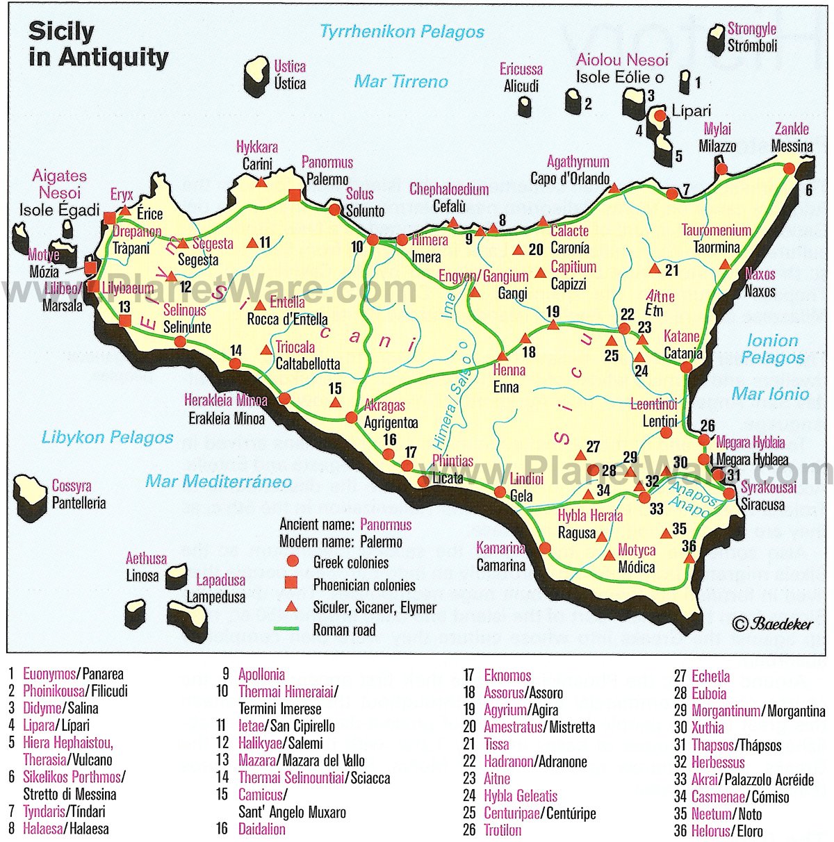
The Trackways and Mixed ways on the map are largely based on modern maps of Roman roads (example map, another example) built centuries after this historical era, on the presumption that the Romans took the path of least resistance and built their roads over existing paths that had connected existing settlements for centuries. A few Trackways were added based on vague descriptions of overland travel in Thucydides, or based on disputes between neighbors. For instance, the Trackway connecting Segesta and Selinous was added for these two reasons.
Other Features of Interest’┐Į

The Greece Box
The Greece Box abstractly represents Greece and the sailing route between Greece and Sicily (the typical journey following the coastlines of Greece and Italy and not striking straight across the Ionian sea). The Greece Box is often the starting location for various leaders. Sadly for the Athenians, they cannot trace a line of supply all the way back to Greece and Athens.
Mount Etna

A massive active volcano that has dominated the Eastern shores of Sicily for half a million years. In Greek myth, Mount Etna was both the prison of the serpent monster Typhon and the location of the forge of the god Hephaestus. Both the Athenians and the Syracusans would have been well aware of this tradition. While the volcano was active, Etna did not have a major eruption during the years depicted by the game. However, Etna was notably active during the 427-424 BCE campaign (Thucydides 3.116), and a few years later in 396 BCE, the Carthaginians halted their invasion of Sicily and withdrew when Etna erupted.
During play, it is possible through an Event that volcanic activity ’┐Į not a full-bore eruption ’┐Į and the ensuing reaction of the populace will temporarily block supply routes in this critical area just north of Syracuse.
Summary

While designing Epipolae (P500), I wanted to capture the setting of Ancient Sicily and highlight the important role that it played in the outcome of the Athenian Expedition to Syracuse. The geography of the island, its cities, inhabitants, roads and pathways, and prosperous agricultural output was just as important as the belligerents and leaders themselves. Indeed, rather than name the game after one of the leaders, the title ’┐ĮEpipolae’┐Į refers to the prominent hill or plateau dominating the landscape outside Syracuse.
I hope this brief glimpse into some design decisions on the game setting gives readers a sense of the depth of research and diligence, and excites your interest in the game.
’┐Į Jay.
Selected Bibliography
Mogens Herman Hansen. The shotgun method: the demography of the ancient Greek city-state culture. University of Missouri Press, 2006. De Angelis, Franco. ’┐ĮEstimating the Agricultural Base of Greek Sicily.’┐Į Papers of the British School at Rome 68 (2000): 111’┐Į48. http://www.jstor.org/stable/40311026. An Inventory of Archaic and Classical Poleis. Ed. by M. H. Hansen and T. H. Nielsen. Oxford University Press, 2004. Darel Tai Engen, ’┐ĮThe Economy of Ancient Greece.’┐Į Economic History Association. https://eh.net/encyclopedia/the-economy-of-ancient-greece/ Thucydides. History of the Peloponnesian War, 5th Century BCE. Translated by Richard Crawley, 1874. Edited by Robert B. Strassler, 1996. The Heritage of Eastern Mediterranean Cultures in Greco-Roman Town of Akrai/Acrae , SE Sicily ’┐Į Scientific Figure on ResearchGate. Available from: https://www.researchgate.net/figure/Akrai-Acrae-marked-on-the-map-of-Sicily-with-the-courses-of-the-ancient-roads_fig1_371774942’┐Į [accessed 9 Dec, 2023] L’┐Įopold Migeotte. The Economy of the Greek Cities. Translated by Janet Lloyd. University of California Press, 2009. R. Ross Holloway. The Archaeology of Ancient Sicily.’┐Į Routledge, 1991Previous Article: Why Levy & Campaign: Ancients?


